A New Library Typology
Greenpoint Library & Environmental Education Center
Introduction
The design process for the Greenpoint Library and Environmental Center showcases the holistic research and design that is central to our firm. It also provided the opportunity for us to integrate unique design, programming, and fabrication methods that emphasize the library’s dual role as both a full-service branch library and a community hub for environmental awareness, activism, and education.
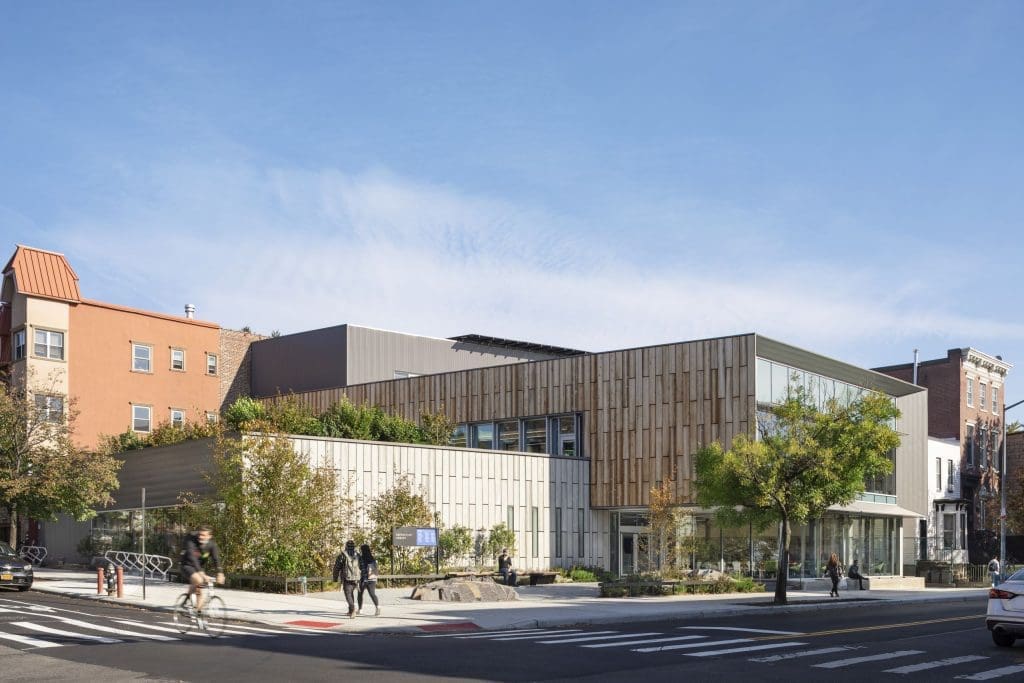
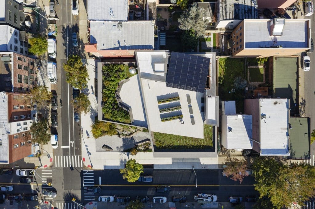
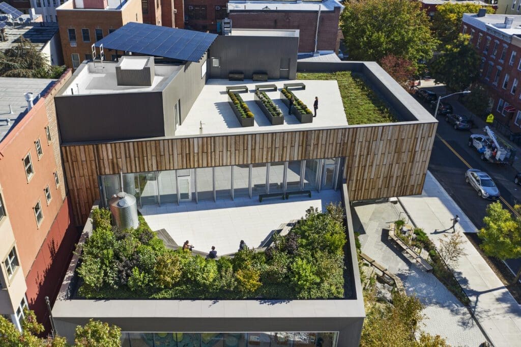
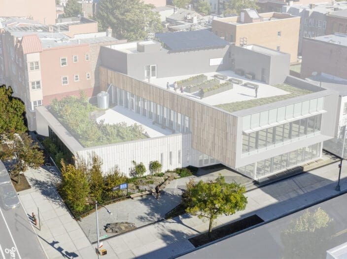
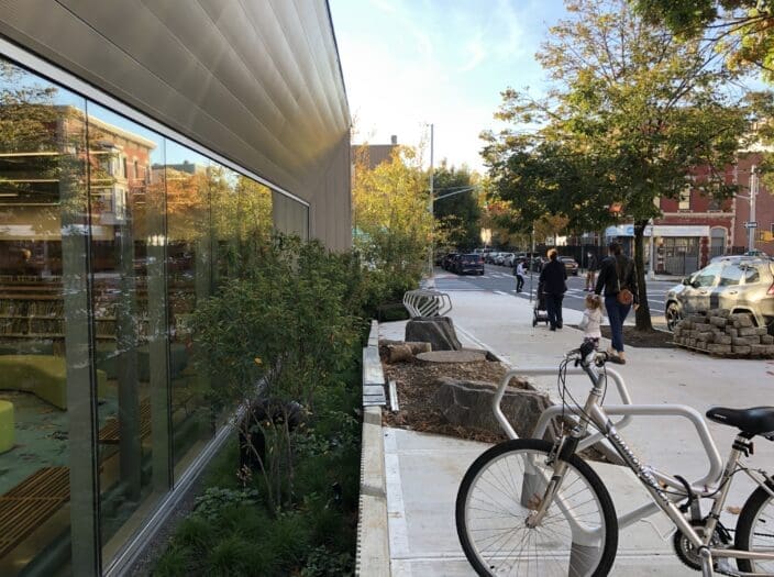
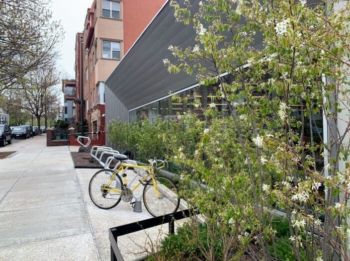
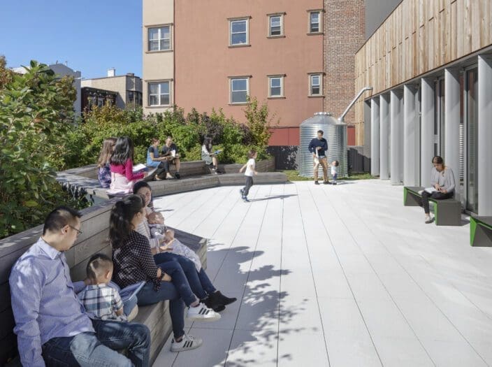
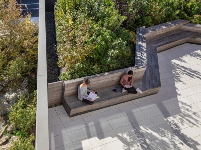
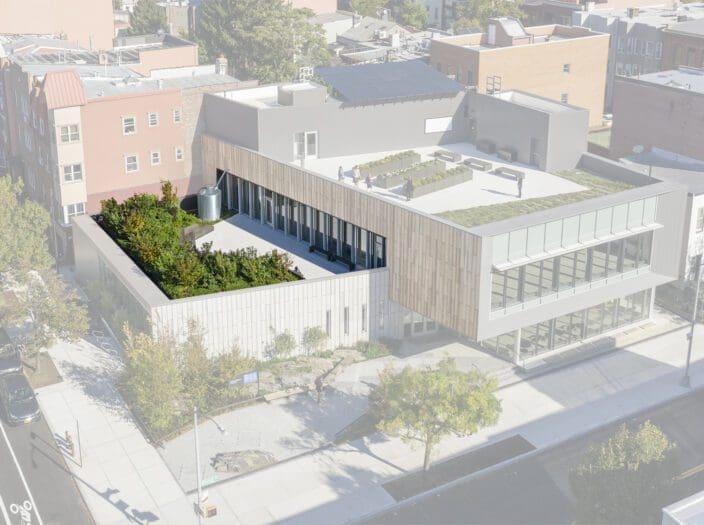
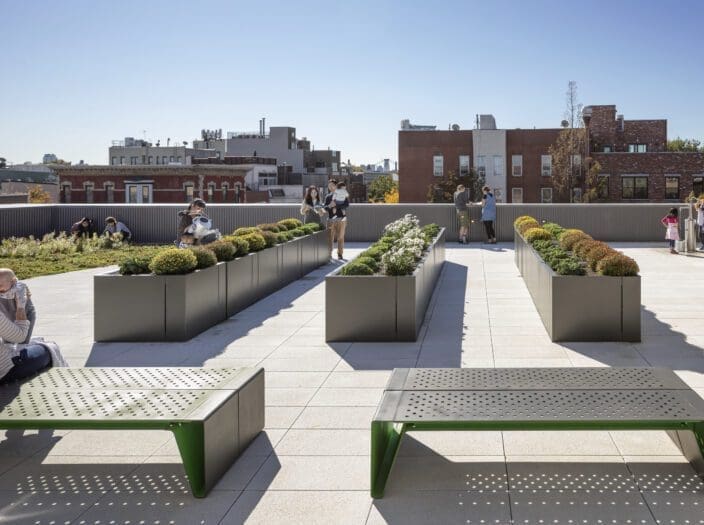
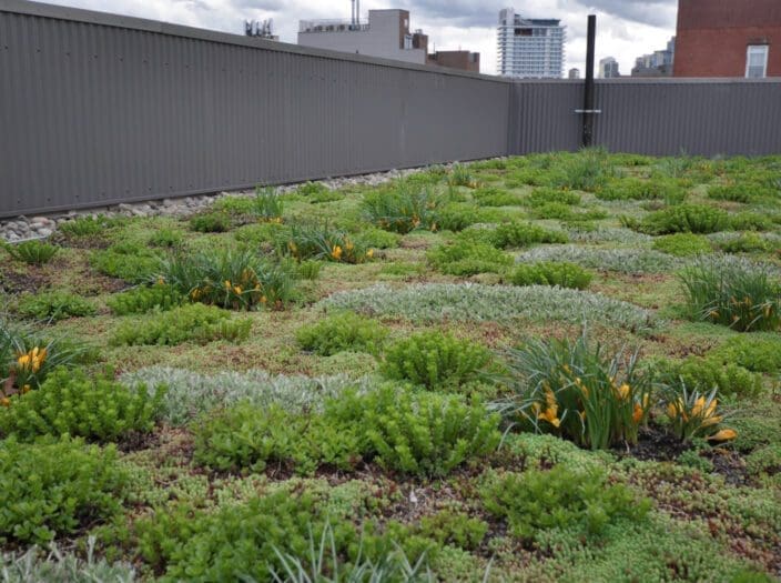
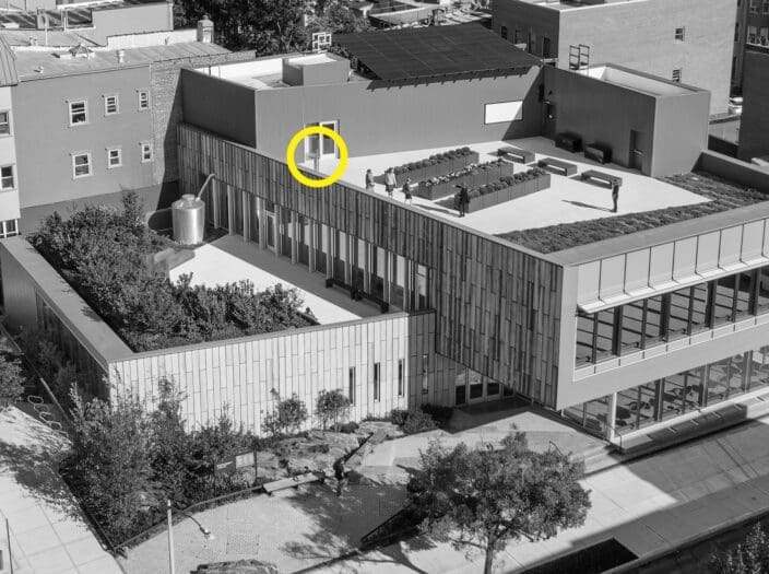
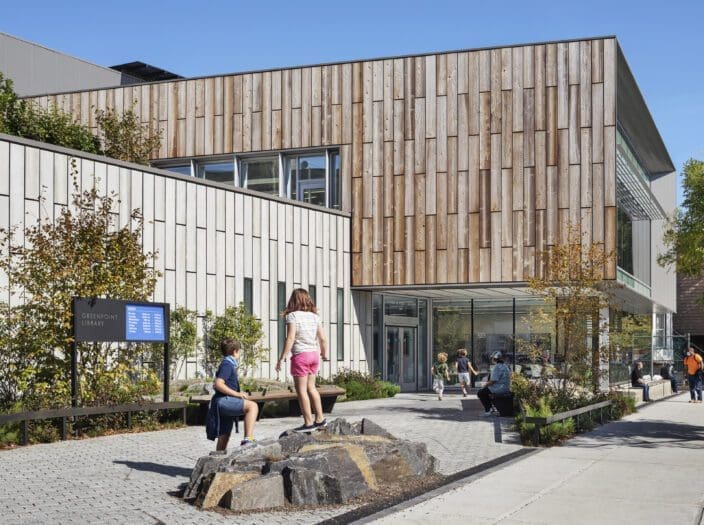
Visitors of the three-story, 15,000 square foot building can enjoy reading, research, classroom, and community spaces that are supported by three separate, planted, exterior areas. These green spaces serve as outdoor classrooms and reading spaces for multi- generational users. Through its water management, building materials, and landscape design, the building is a demonstration project for innovative approaches to sustainable design and a learning tool for the community. Below, we highlight the process that led us there.
Greenpoint Brownfield History
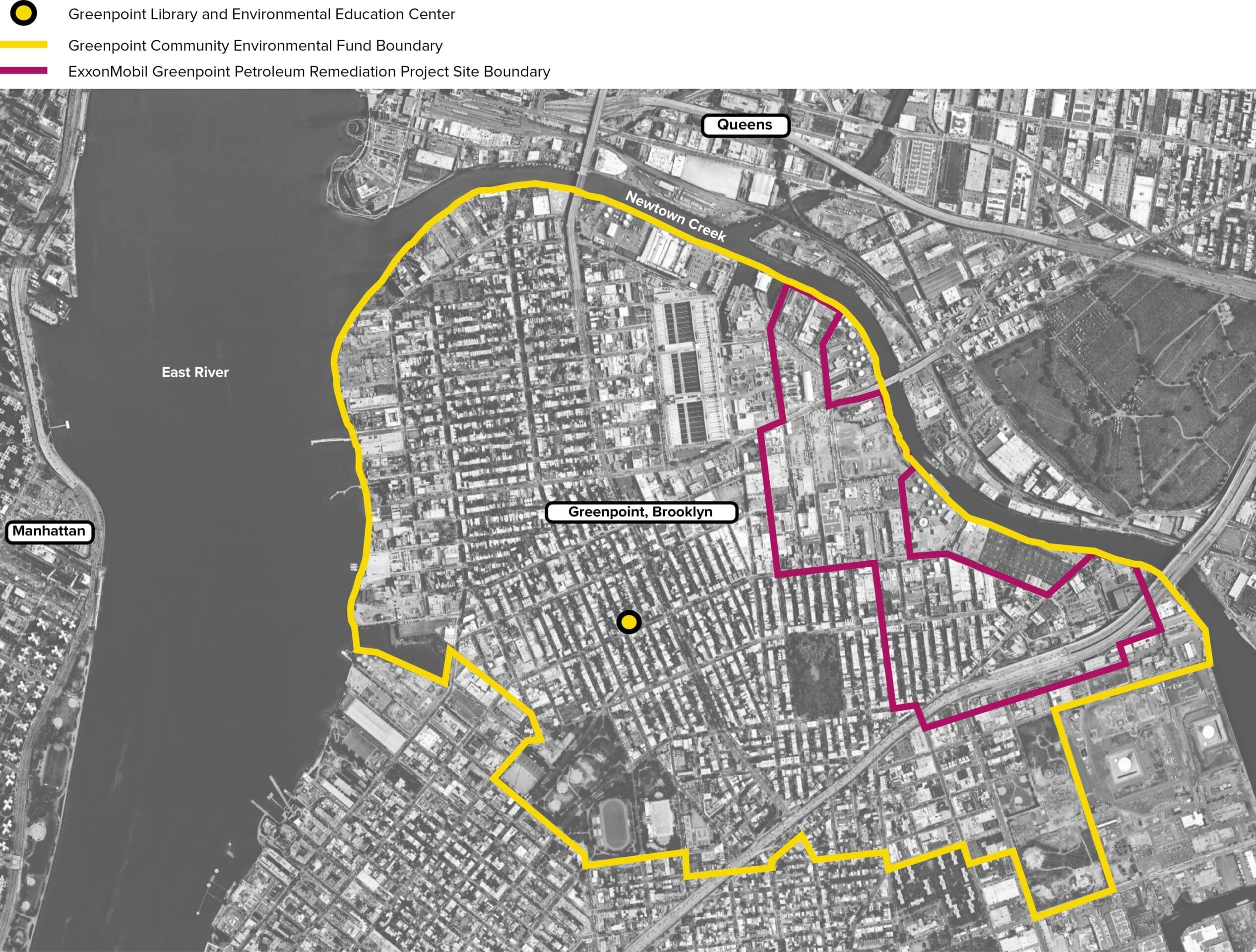
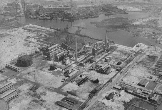
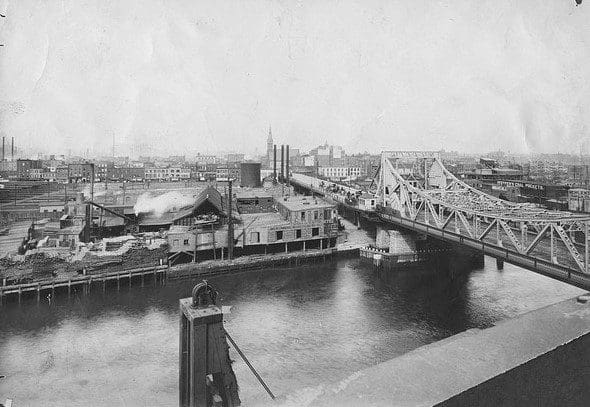
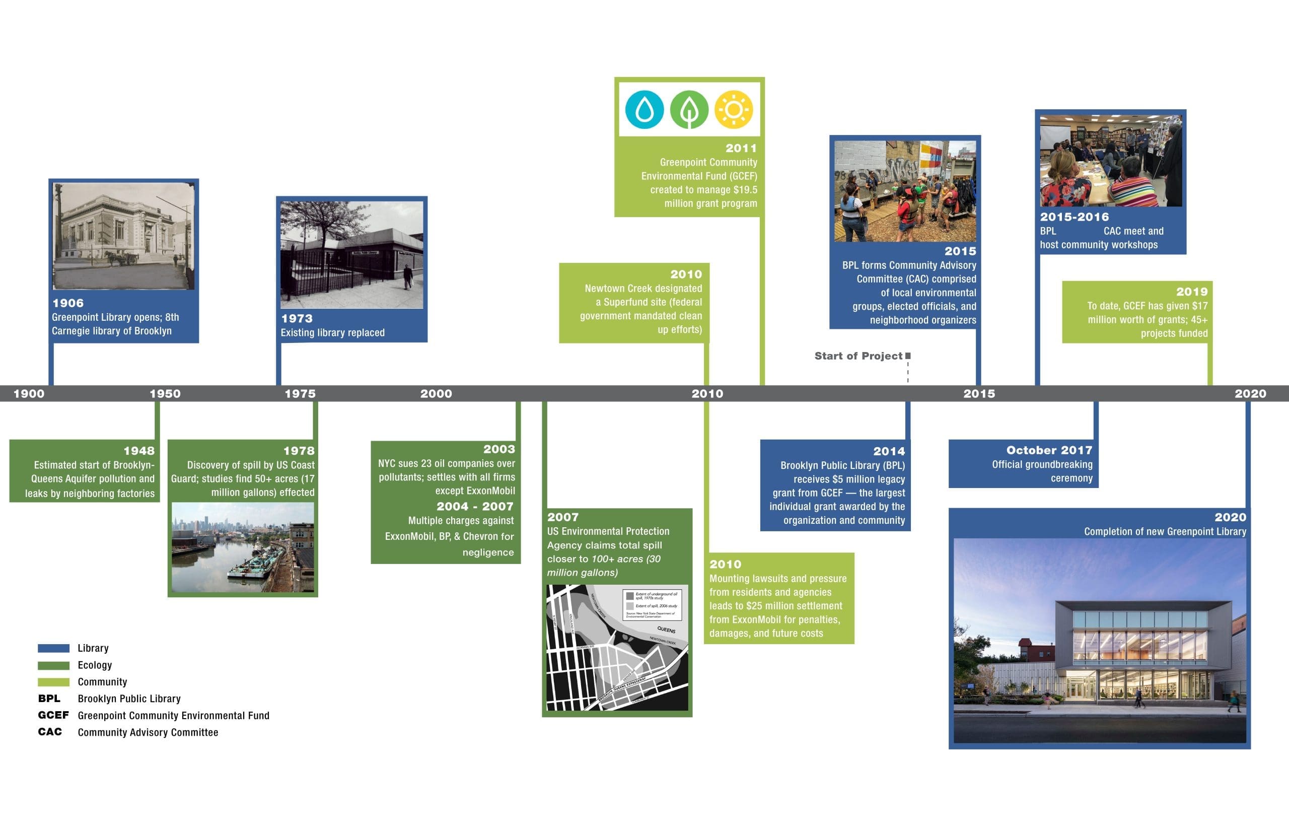
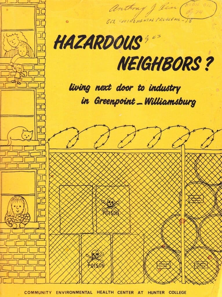
Brooklyn’s Greenpoint neighborhood, located at the northwestern tip of Brooklyn, has historically been the site of intense industrial activity for over 140 years, starting with the creation of whale oil refineries in 1834. The neighborhood—a mix of residential, commercial, and industrial zones—is bound by the Newtown Creek to the north and east, Williamsburg to the south, and the East River to the west. By 1900, gasoline and fuel refinery and storage was the main industry in the Greenpoint neighborhood, especially along the Newtown Creek. Refinery operations continued until 1968, and oil storage operations still exist in the neighborhood today.
In 1978, the U.S. Coast Guard identified oil spilling into Newtown Creek. Further investigation revealed that a 52 acre area along the creek was contaminated with a combination of various oil products, totaling at least 17 million gallons. Most of this oil sat above the water table, impacting the soils and groundwater of both a local and regional aquifer. In 2010, the federal government designated Newtown Creek a Superfund site, which empowers the Environmental Protection Agency to force parties responsible for pollution to clean up contaminated sites.
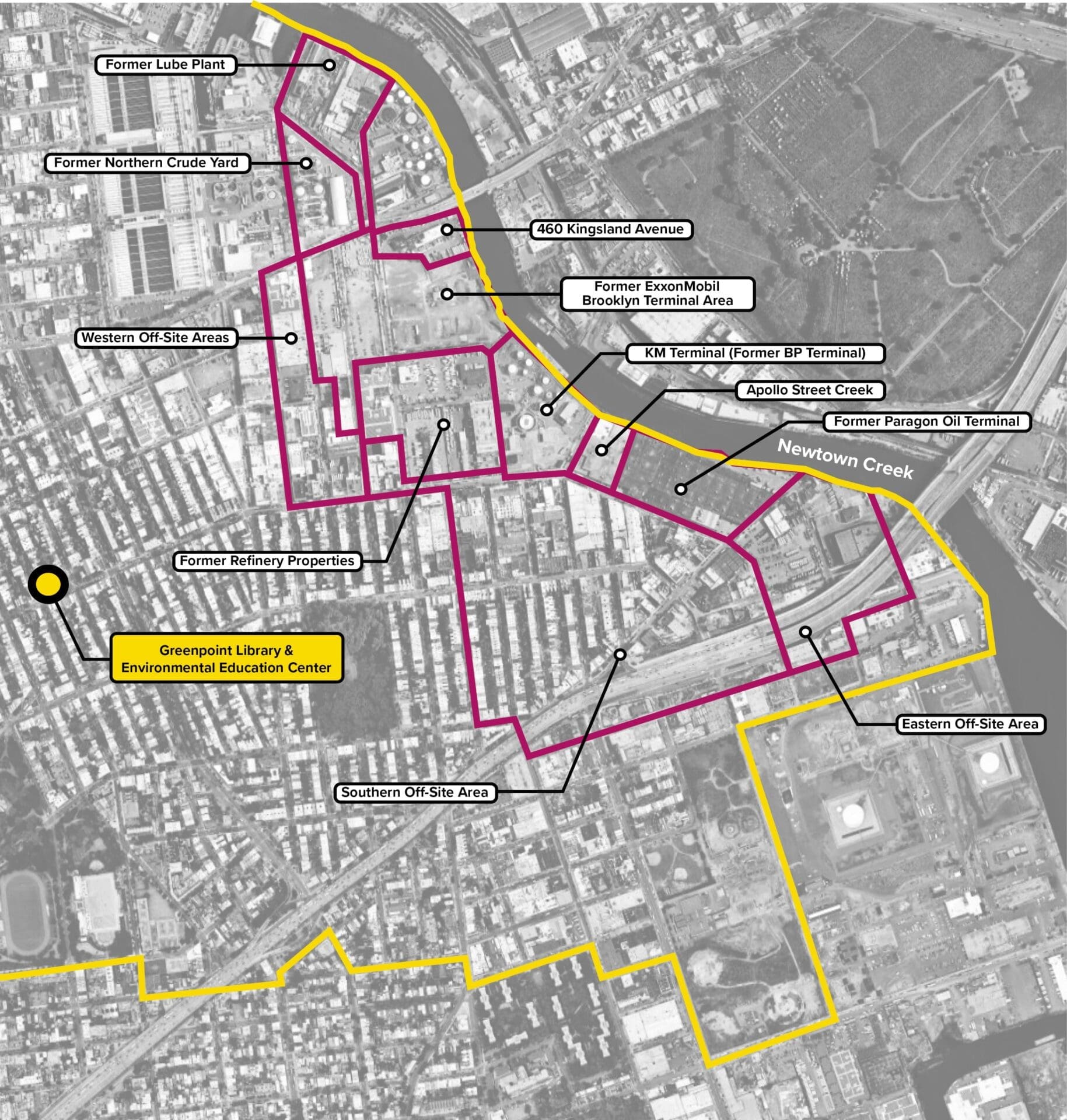
Many of the “Potentially Responsible” parties have engaged in environmental remediation efforts since the discovery of the oil spill, including the pumping out of petroleum products sitting above the water table. When one of those parties, ExxonMobil, reached a settlement with the State of New York over the spill, the NYS Office of the Attorney General and the Department of Environmental Conservation used the settlement money to create the Greenpoint Community Environmental Fund (GCEF). The goal of the GCEF is to fund projects focused on improving the environmental conditions of buildings, infrastructure, and public space in Greenpoint. These include environmental stewardship and education programs, the creation of green public spaces, and waterfront restoration projects.
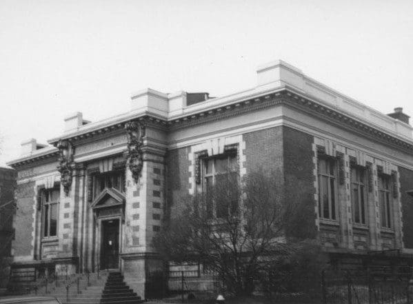
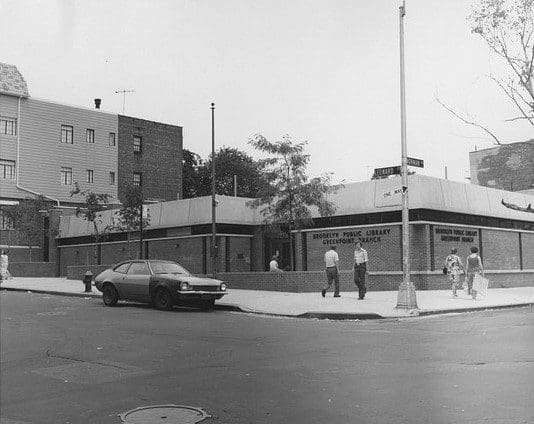
The current location of the EEC was home to one of the first Carnegie libraries, built in 1906. That building was demolished and replaced by a “Lindsay Box” library in 1973. The nickname referred to the low-slung, inexpensive, modular library buildings built by the administration of mayor John Lindsay.
In 2014, the GCEF awarded the Brooklyn Public Library more than $5 million to renovate the Greenpoint branch library and turn it into an Environmental Education Center (EEC) that would serve as a hub for community engagement and education focused on the environment. With support from GCEF, BPL, and various other community partners, the EEC was to become a repository for the environmental history and activism in the Greenpoint neighborhood, including its history of environmental contamination and the efforts for remediation.
In 2015, Marble Fairbanks was selected as the project architect. In 2016, due to cost issues and the deteriorated conditions of the existing library, the GCEF and BPL’s Community Advisory Committee determined it was preferable to construct a new building.
In addition to providing funds for the library construction, the GCEF awarded BPL money to create environmental education curriculum, create the Oral History Project, create community photo archives, and hire a part-time Outreach Archivist, among other initiatives.
Site Analysis / Process
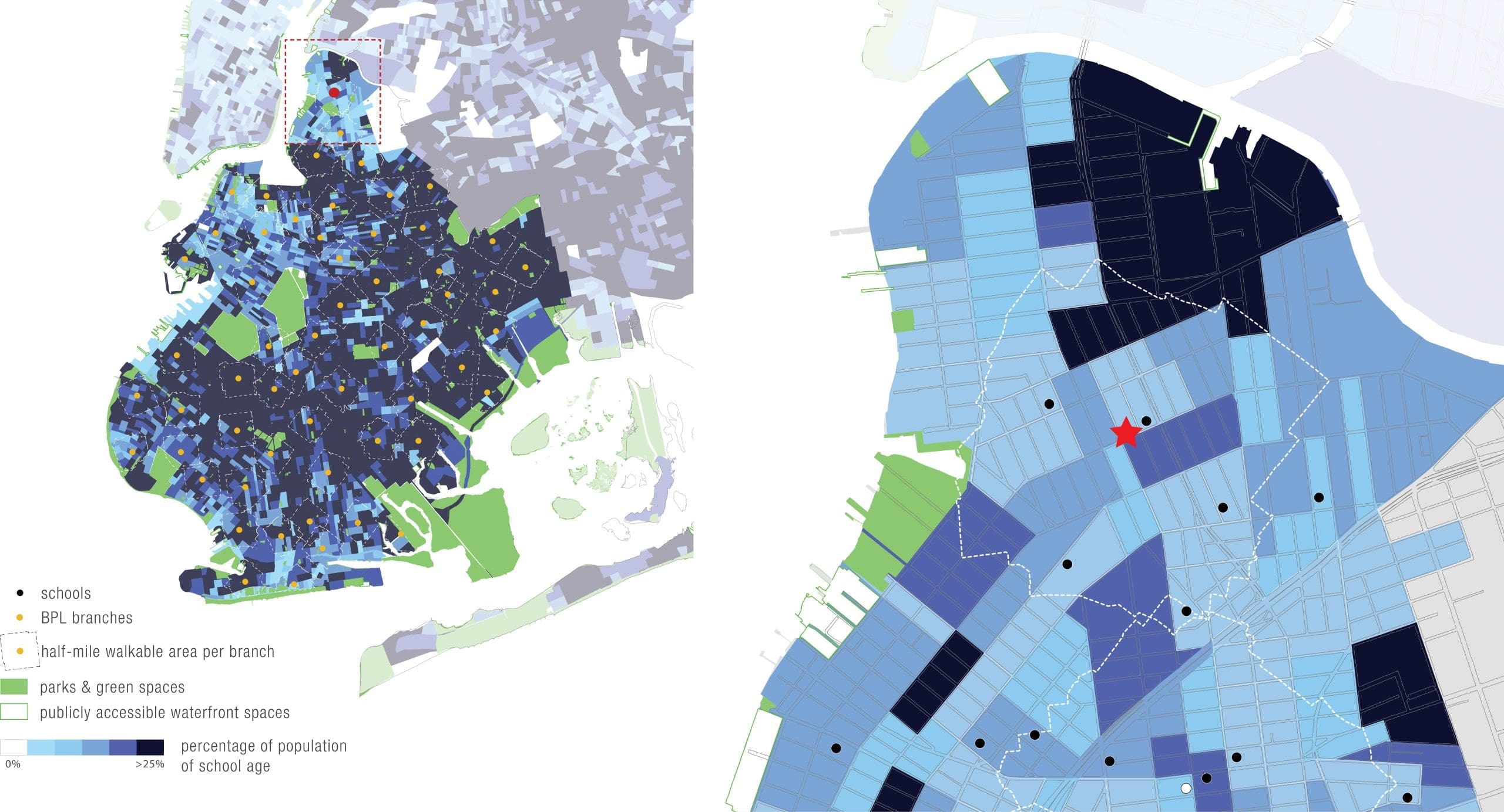
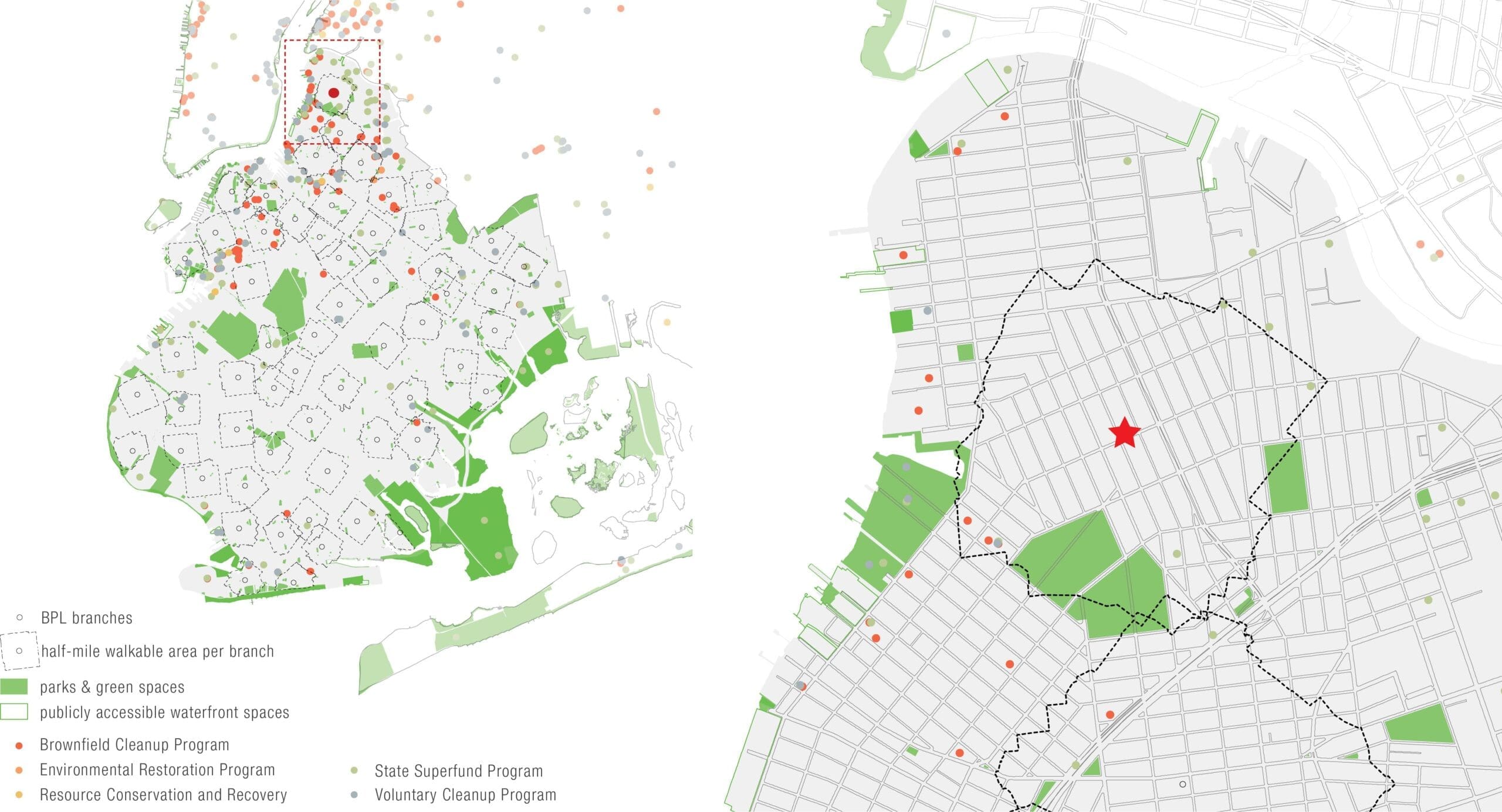
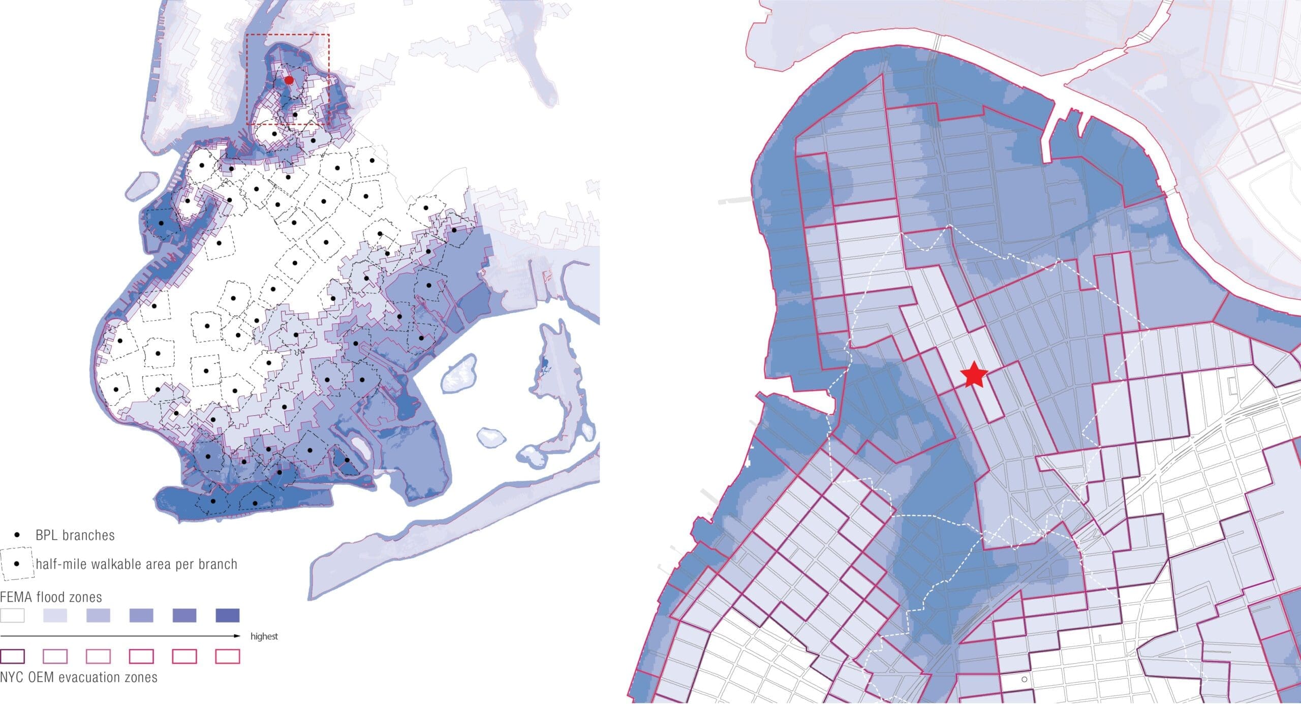
Marble Fairbanks studied the library site at various scales: the borough (Brooklyn), the neighborhood (Greenpoint), and the lot itself, at the northeast corner of Norman Avenue and Leonard Street. For the two larger scales, we used GIS to study relationships between the site and the people living there.
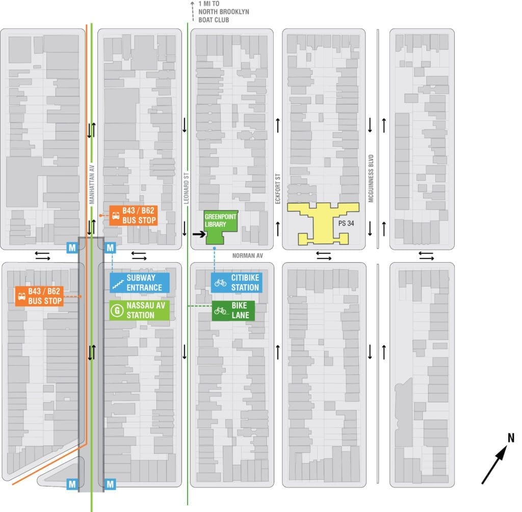
In the first pair of maps, we saw that Greenpoint as a whole has a smaller percentage of school age children in comparison to most other neighborhoods in Brooklyn. The second pair of maps indicates that much of northern Greenpoint is not within a half-mile walking distance of a park or green space. It also shows that most of the brownfield cleanup programs in Brooklyn are located in the northern part of the borough, including Greenpoint. The same can be said of environmental restoration programs and resource conservation and recovery programs. When looking at the neighborhood scale, however, most of those program sites are located outside of the half- mile radius from the Greenpoint Library branch. The final pair of maps shows that, while much of Greenpoint is within a FEMA flood zone, the library site is located in one of the neighborhood’s areas least likely to flood. A final map at the neighborhood scale shows the ten city blocks surrounding the library site. Though the site has been home to branch libraries since 1906, it continues to be an ideal location, given its proximity to the G subway line, bus lines, and bicycle infrastructure.
Population of school age residents in Greenpoint and Brooklyn
Remediation programs in Greenpoint & Brooklyn: Risk & Environmental Resilience for the Greenpoint Library
Flood risk and evacuation zones in Greenpoint & Brooklyn: Risk & Environmental Resilience for the Greenpoint Library
Site Context
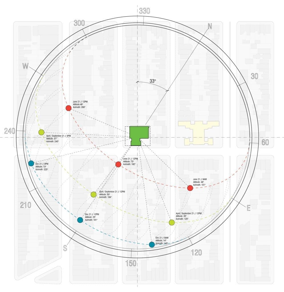
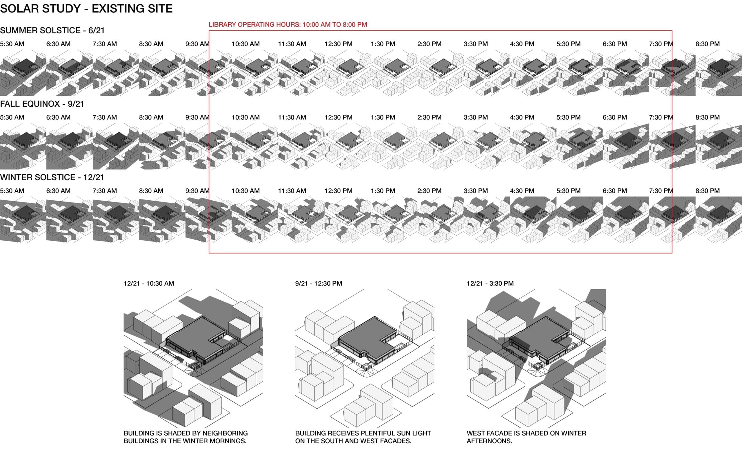
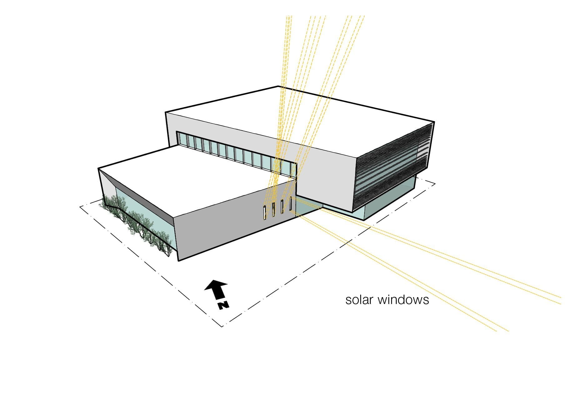
Solar Study
At the scale of the lot, a combination of sun path diagrams and solar studies using a digital 3D model allowed us to determine how much of the site sits in the shadow of surrounding buildings. Given the lot’s location at the northeast corner of a neighborhood where the tallest surrounding buildings are four stories, a building on the site receives plentiful sunlight on its southeast and southwest facades. During the winter mornings and afternoons, however, neighboring buildings cast shadows onto the site, given the lower angle of the sun’s altitude during that time of the year.
Site Shadow Study
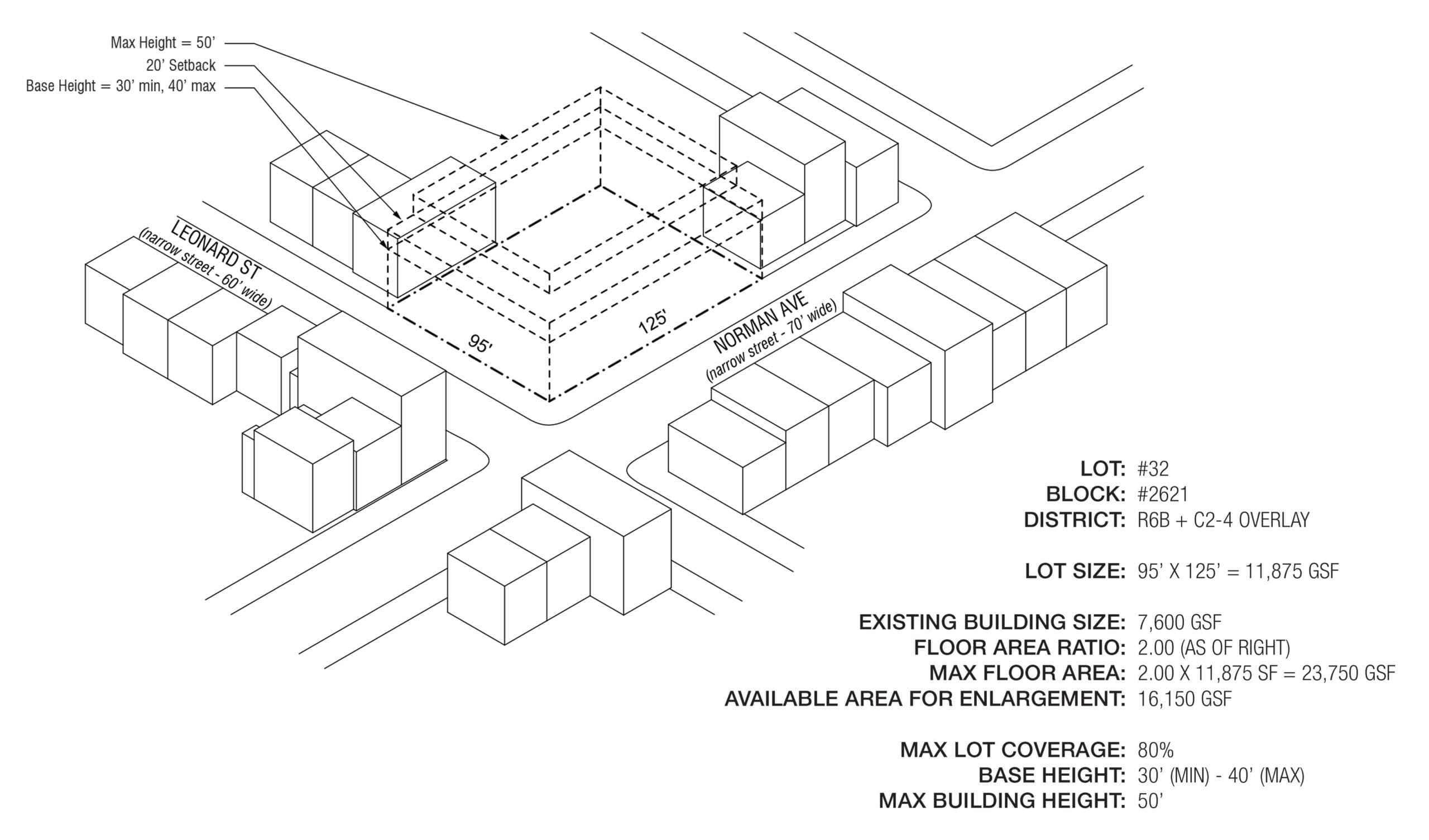
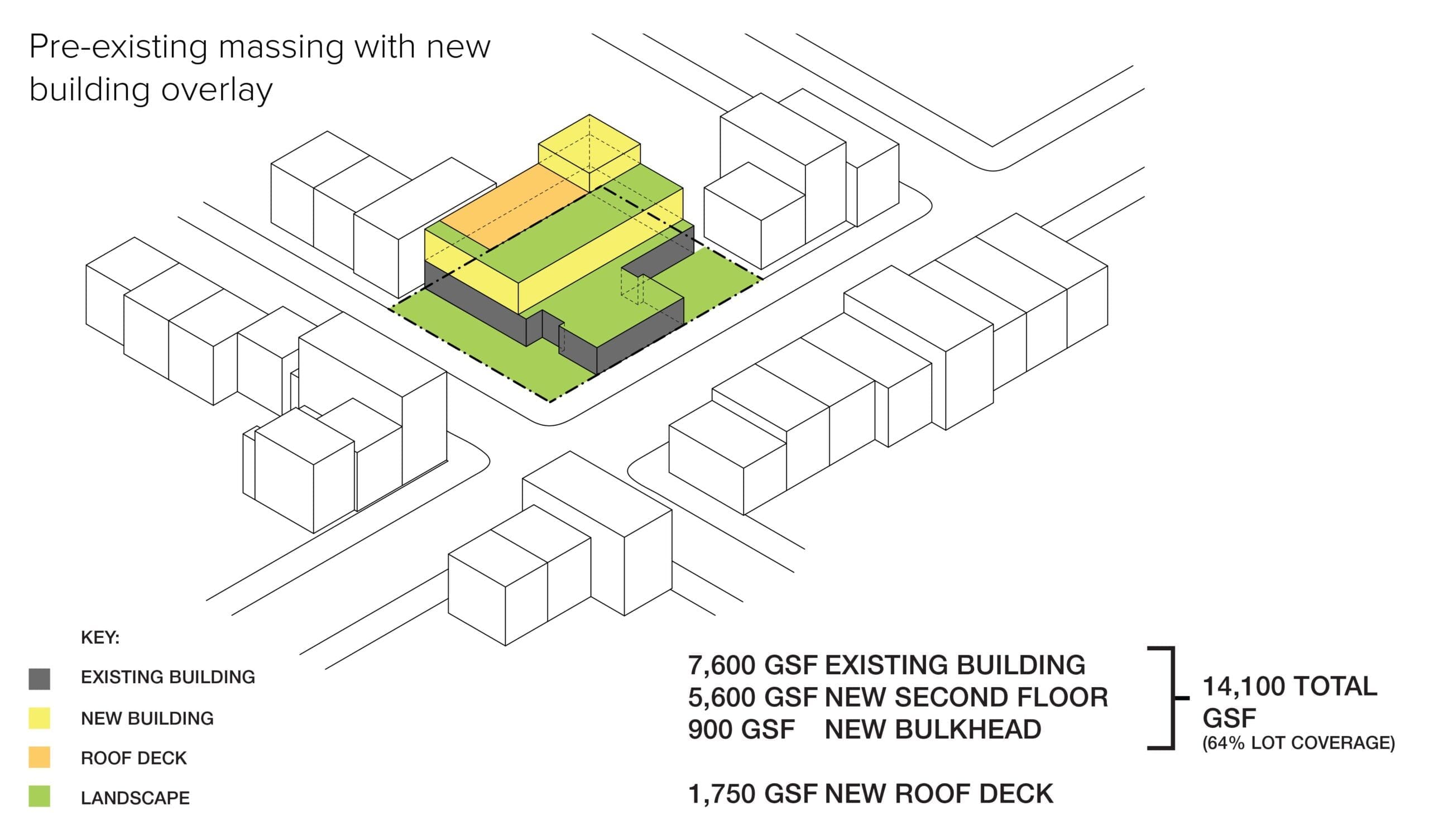
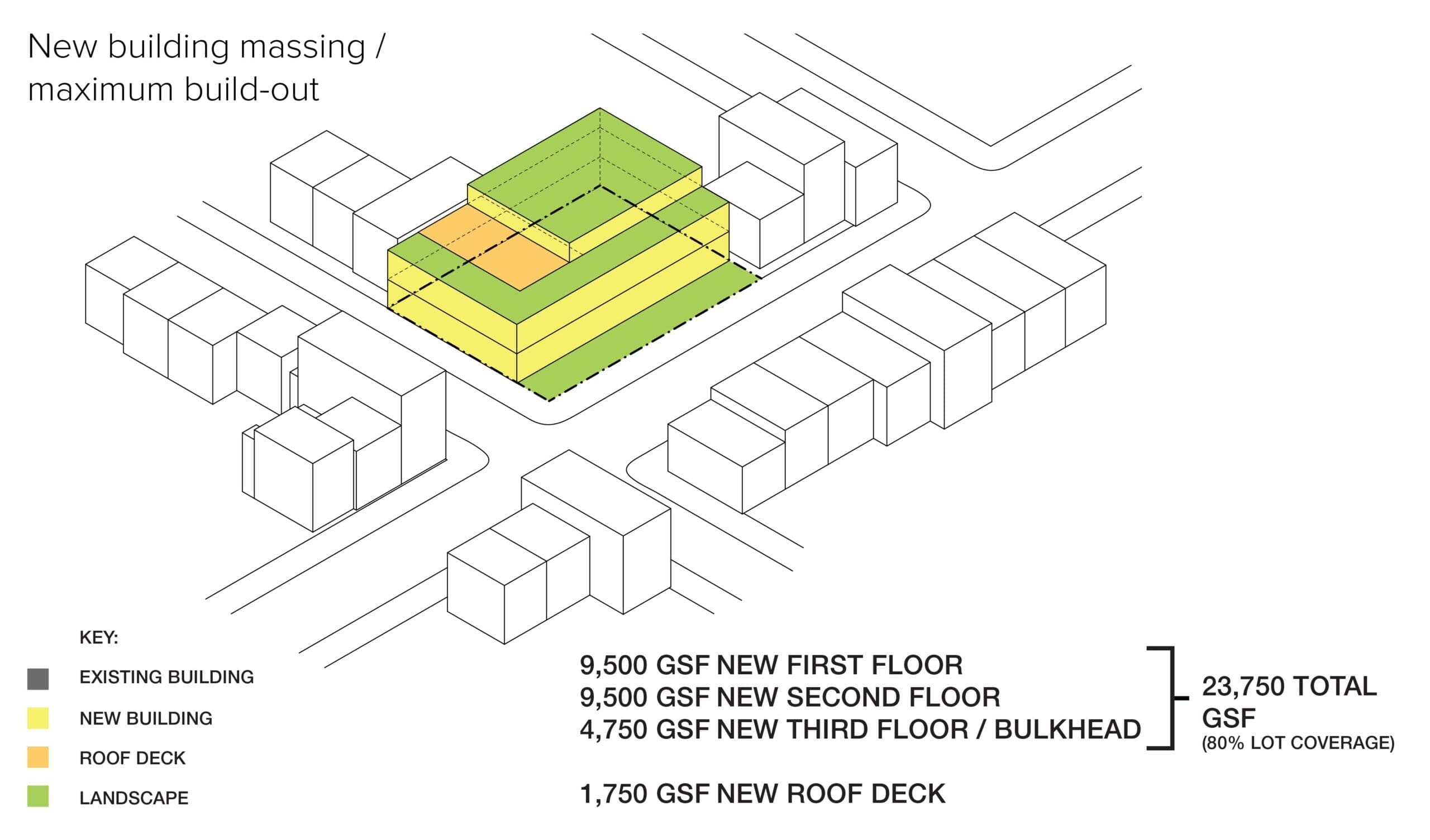
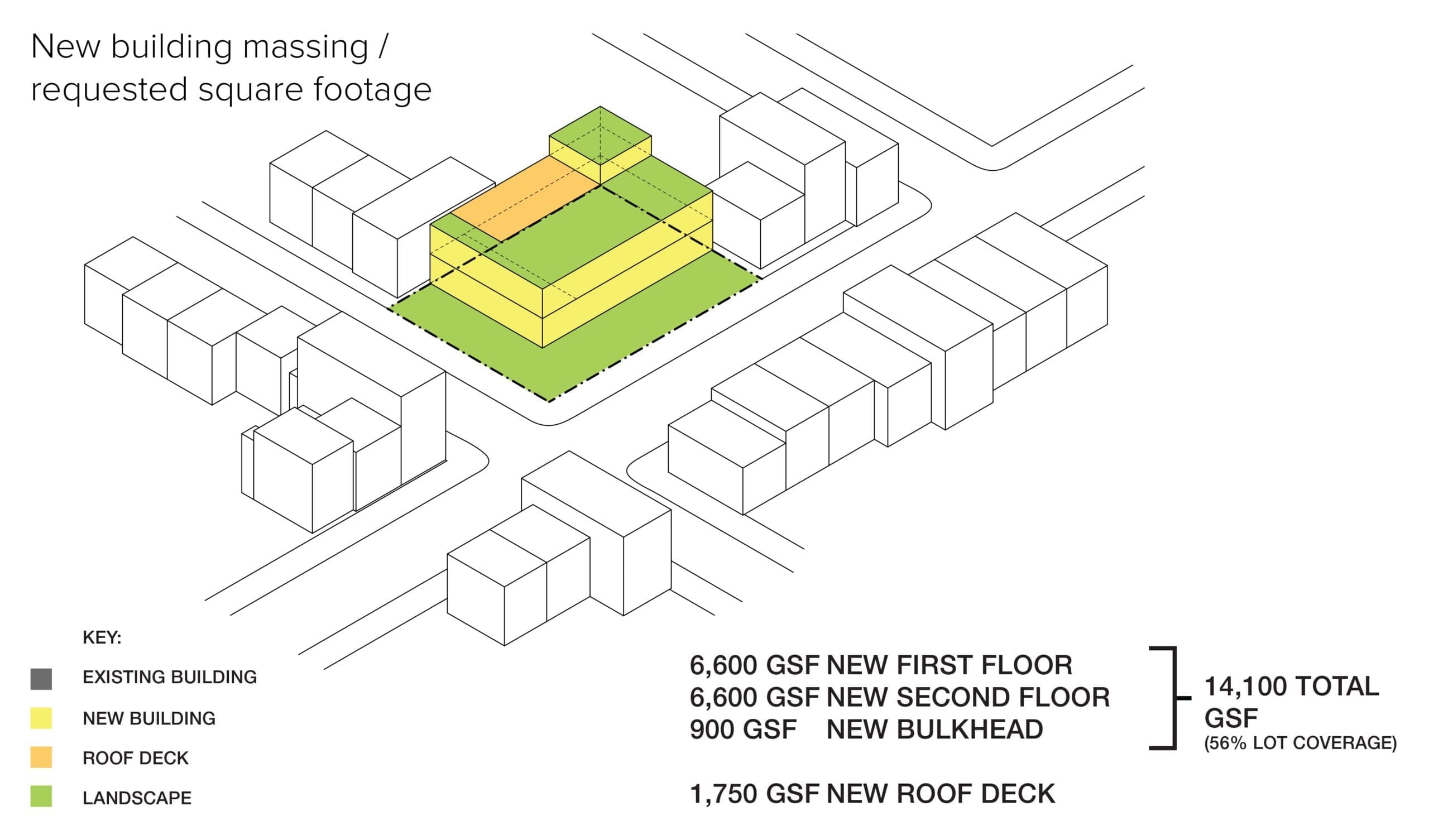
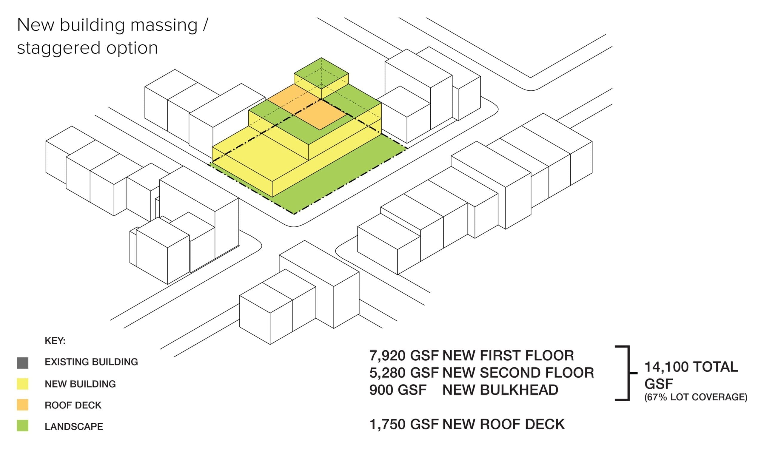
Zoning Envelope
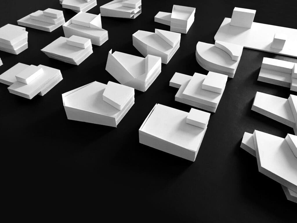
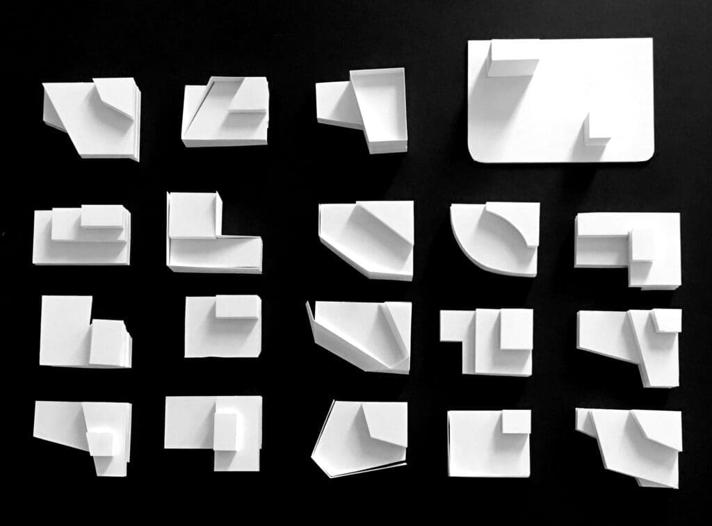
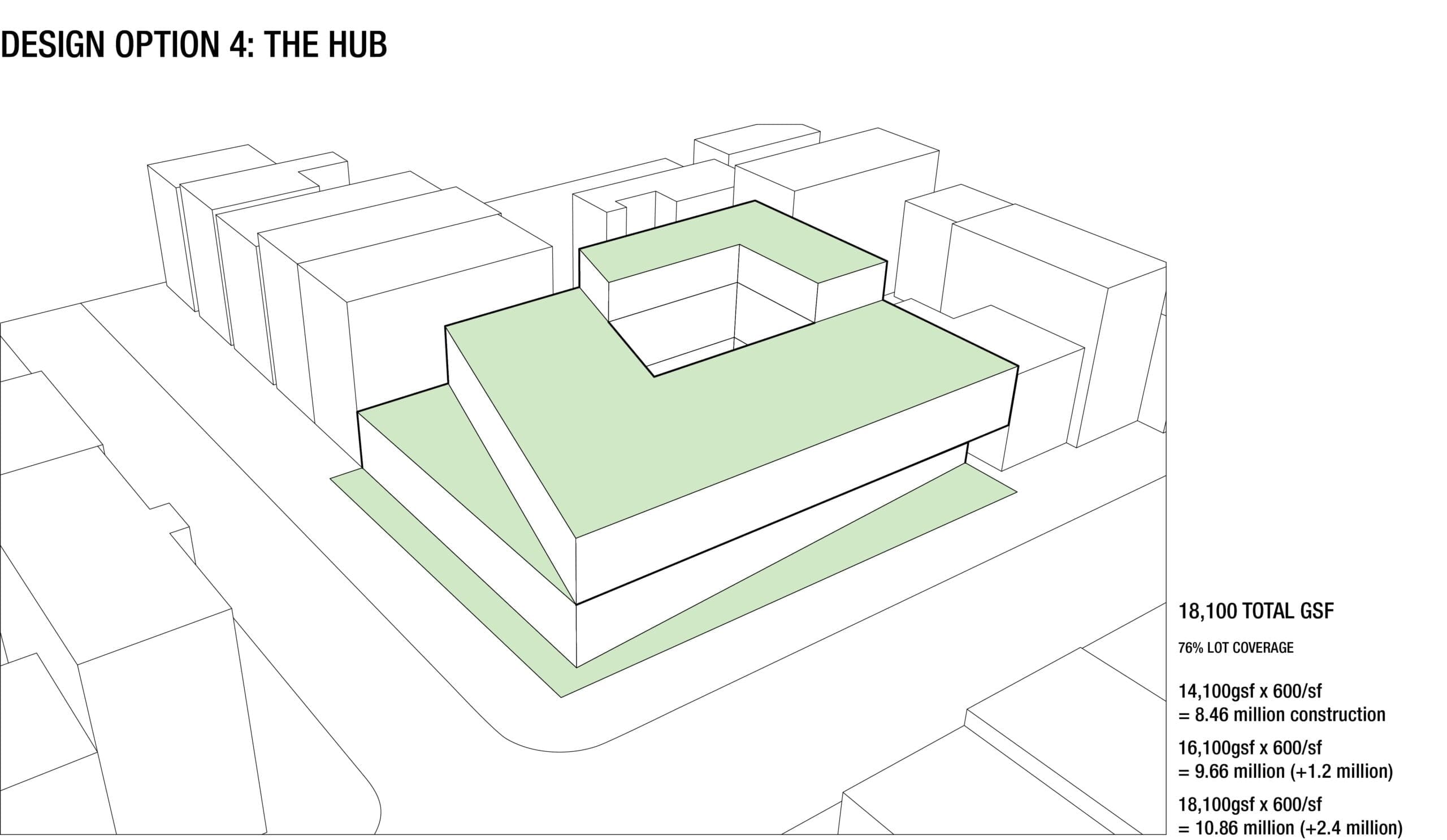
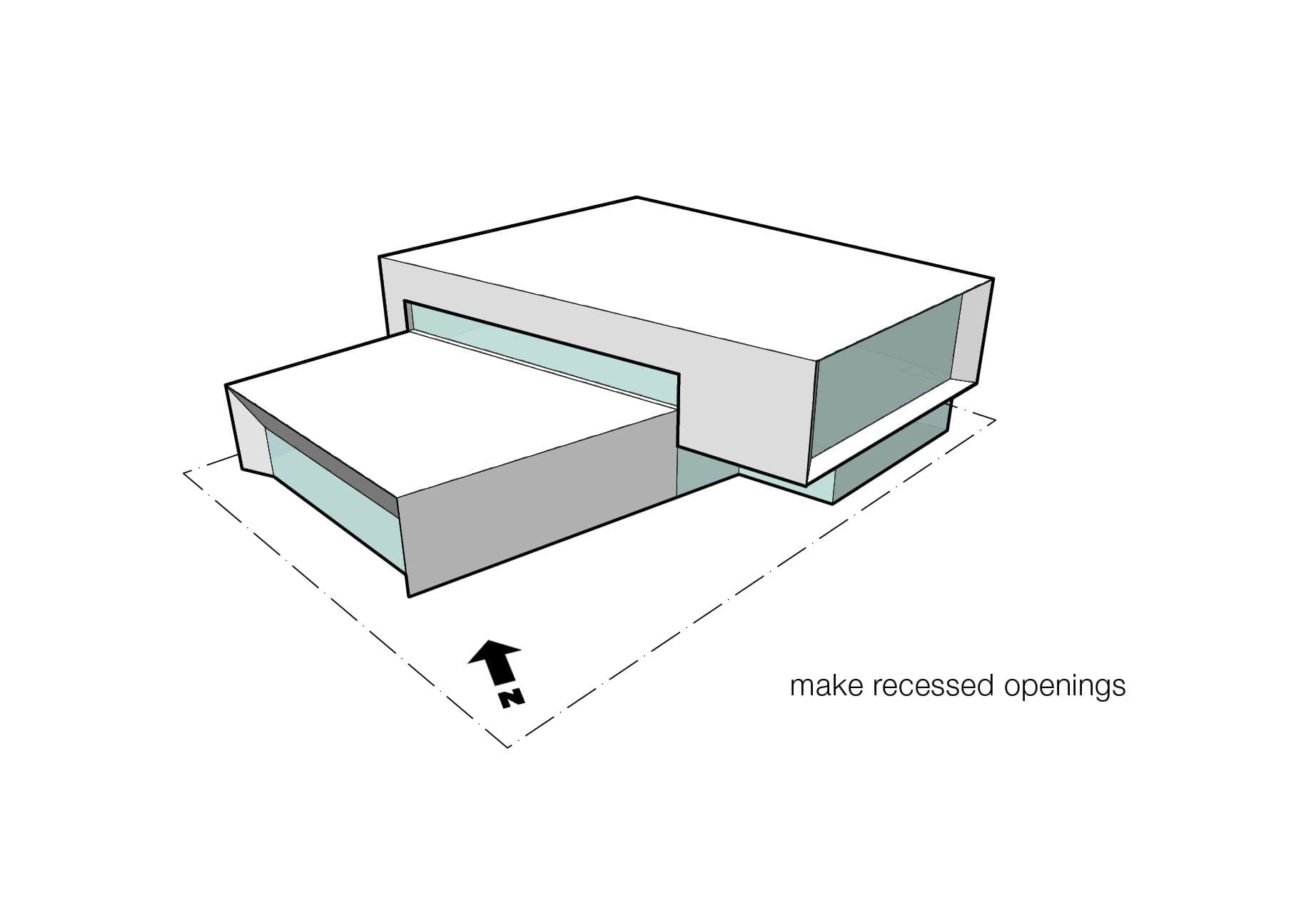
We used axonometric views to better understand the constraints created by NYC zoning at the lot scale. Given its as-of-right Floor Area Ratio (FAR) of 2.0, a new building on the lot could be up to 23,750 gross square feet (GSF), allowing BPL to easily accommodate a 15,000 square foot (SF) library that would double the size of the previous library on the site. In addition to height and setback requirements, the lot was constrained by a maximum coverage of 80%, as illustrated by the grid plan thumbnails. The following axonometric views show different build out scenarios, including the maximum build out and the build out of the requested program size. Other iterations show how the lot coverage changes as outdoor terraces and interior double height spaces are added or removed.
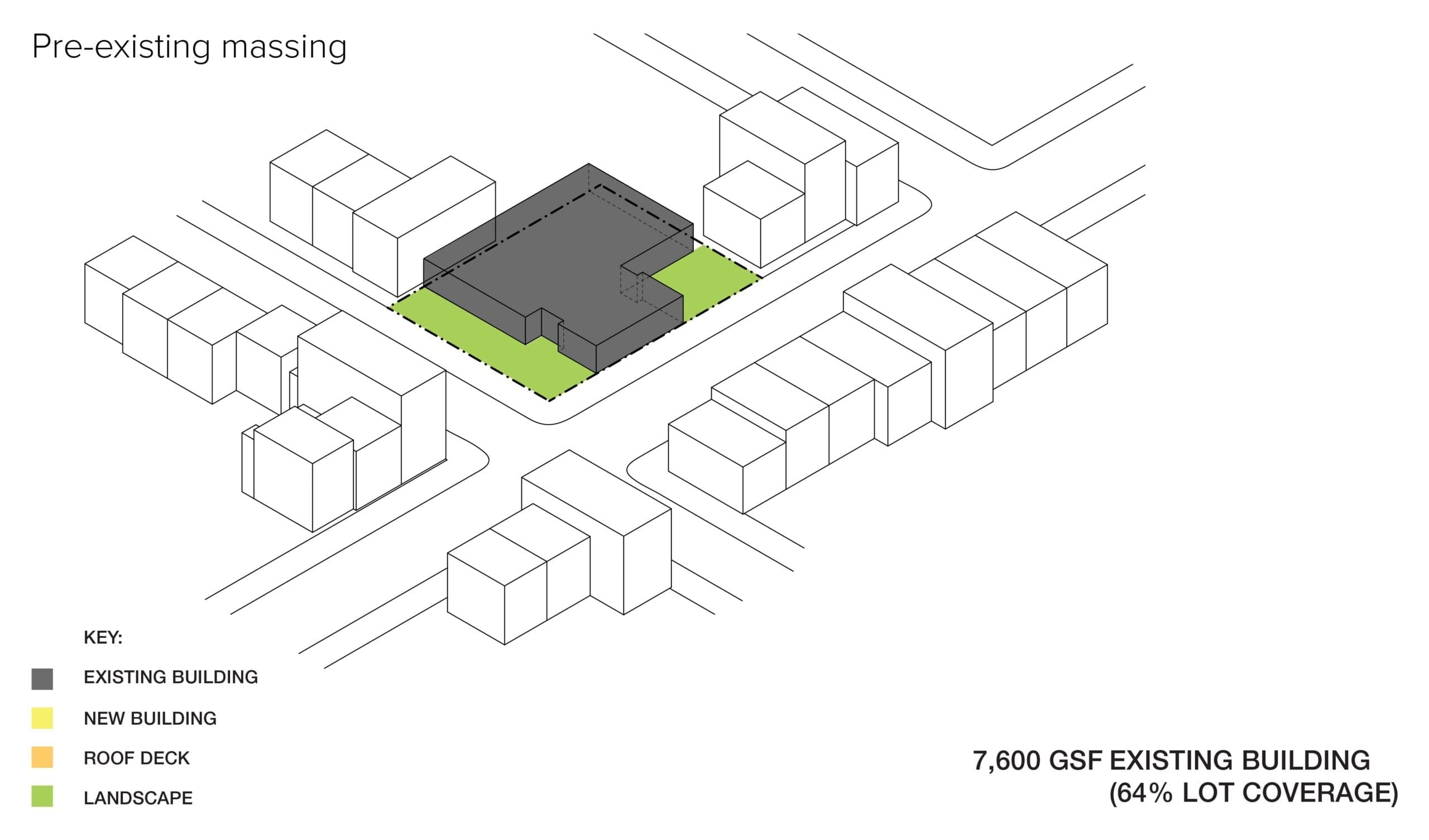
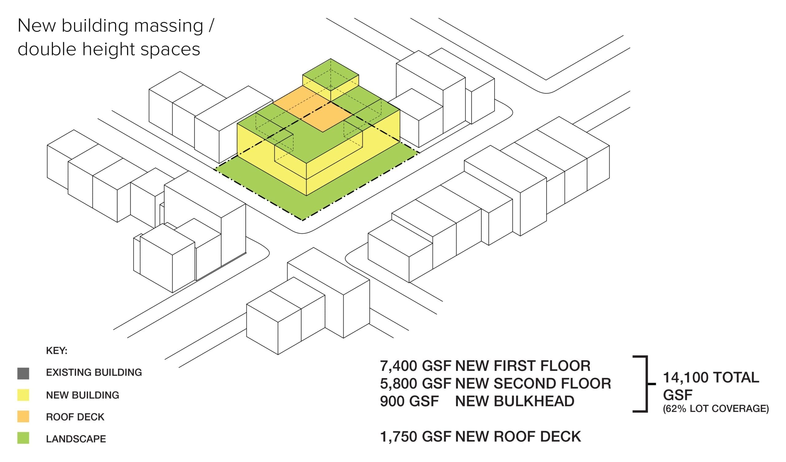
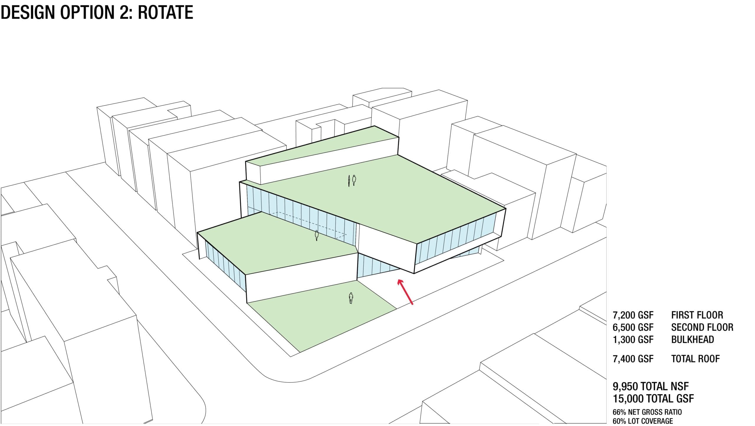
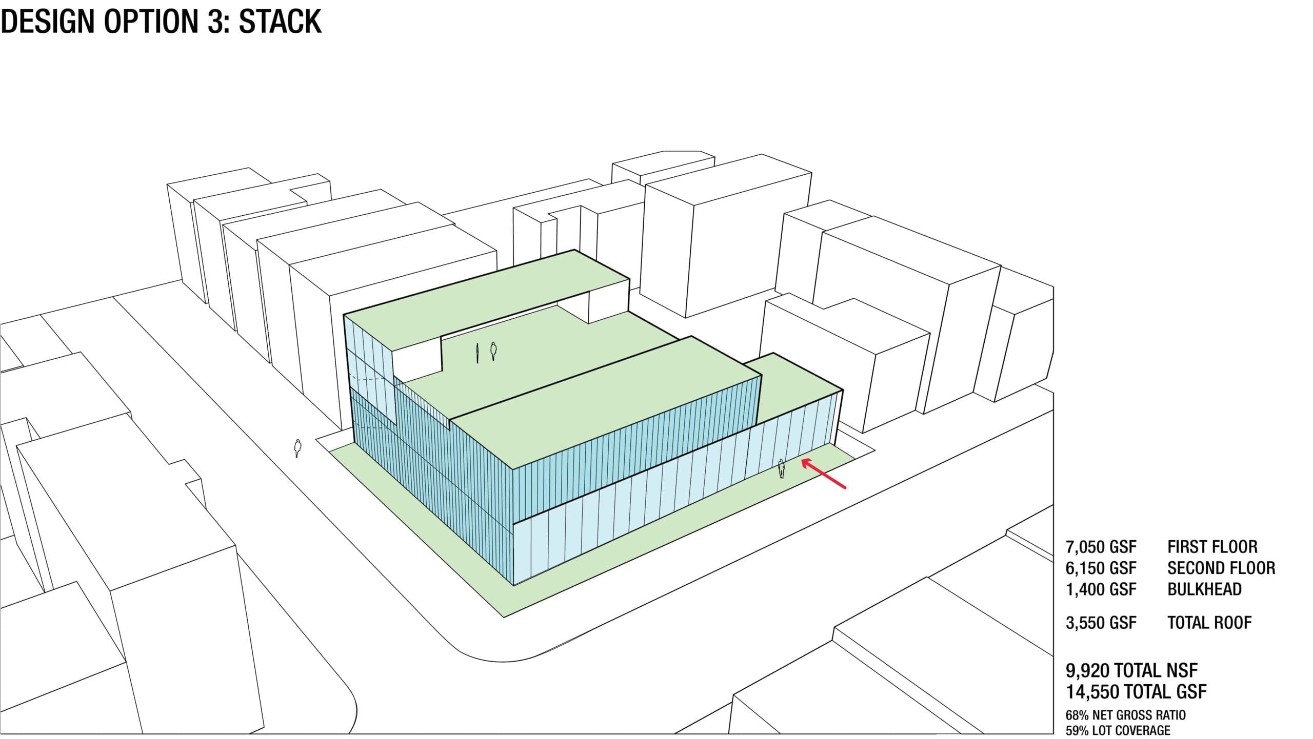
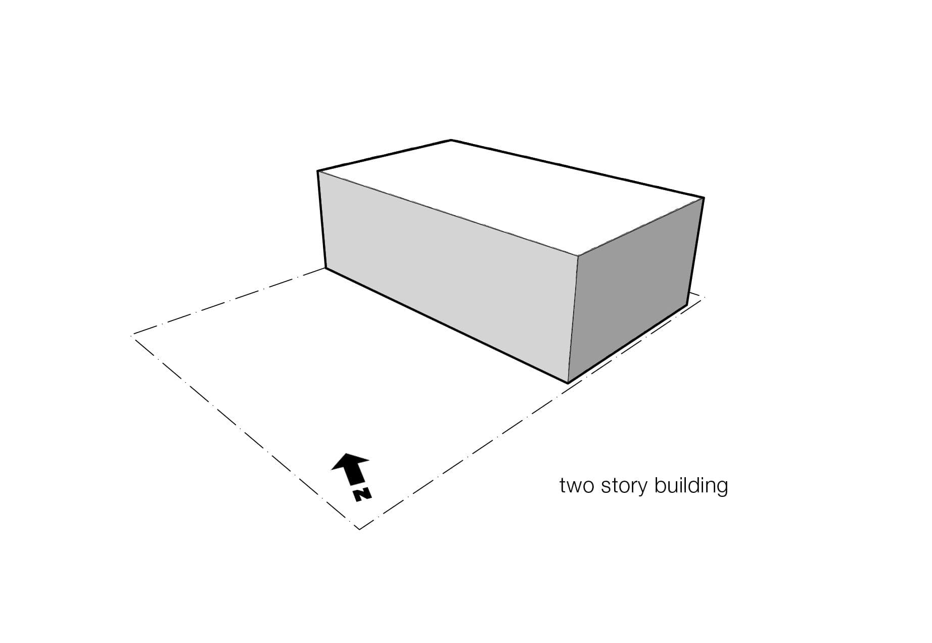
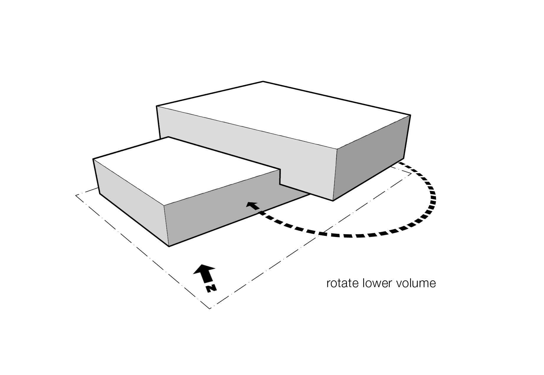
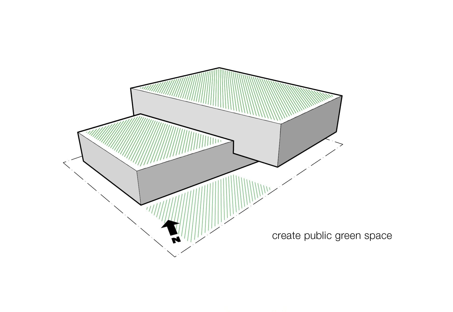
Site Massing Development
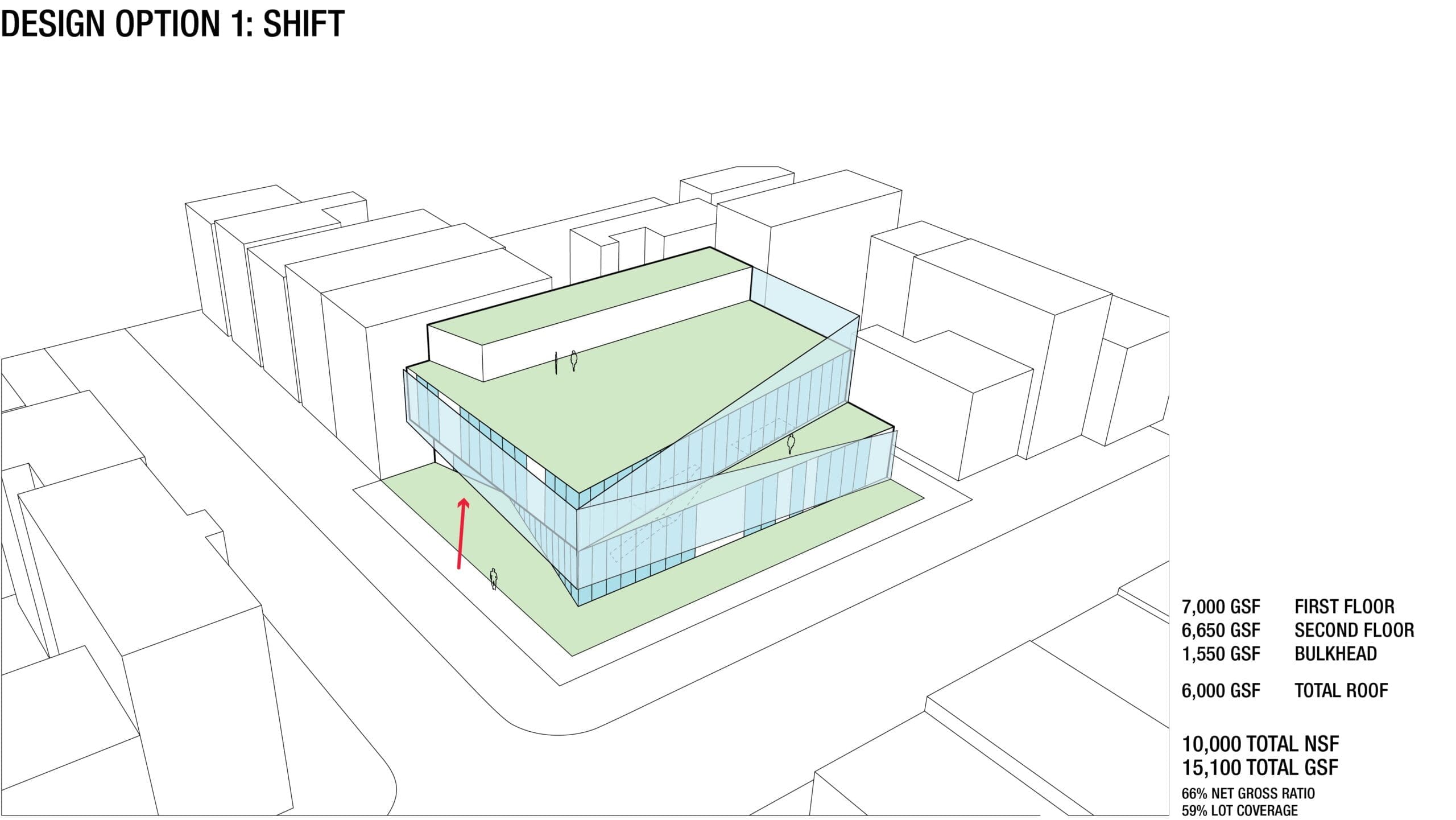
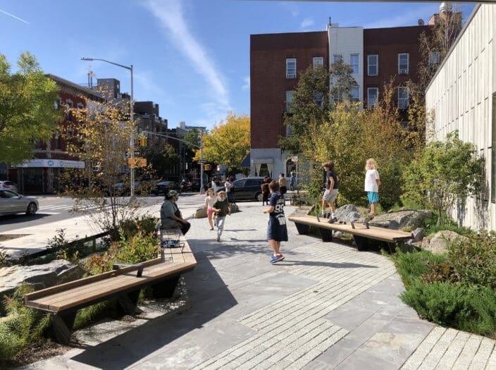
Site massing development was an iterative process that balanced zoning constraints, environmental conditions (shade, sun), programmatic requirements and the desire to have exterior, public spaces at the ground floor. We tested countless options using both digital and physical massing models. We then refined four of the preferred models into schematic design options that were developed through feedback from the client. These options also showed schematic floor plans and material palettes. Ultimately, the Rotate scheme—which allows for public space and seating along its southeastern facade—most closely resembles the massing of the new, completed project.
Environmental Education
Upon receiving the project grant for the Greenpoint Library and Environmental Education Center (GEEC), Brooklyn Public Library (BPL) created a Community Advisory Committee (CAC) that included local residents, neighborhood organizers, environmental groups, and elected officials. Together they shaped project goals for the library’s mission and programming.
They decided that the building and its landscape were to provide hands-on learning experiences that would expose visitors to environmentally conscious, sustainable building practices, while also providing opportunities for learning about the neighborhood’s past and present environment.
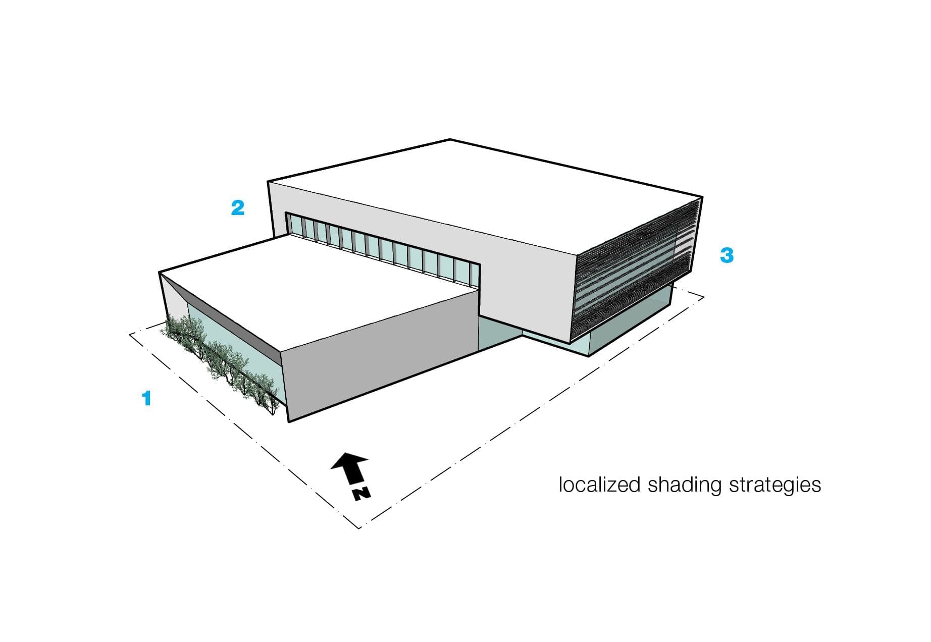
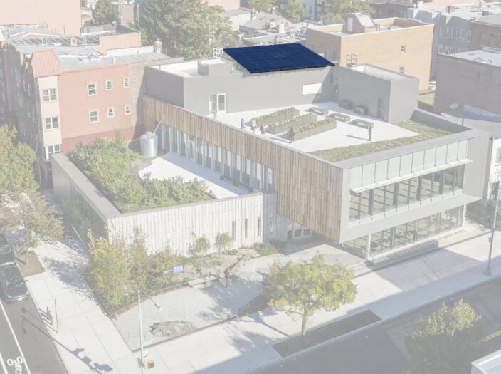
The completed library is a LEED Gold building that showcases innovative approaches to sustainable design through its daylighting, use of green spaces, energy-efficient HVAC system and fixtures, photovoltaic panels, and material use. In collaboration with New York City-based landscape architecture firm SCAPE, Marble Fairbanks designed a streetscape and rooftops that physically engage visitors with local ecologies, geologic history, and water management.
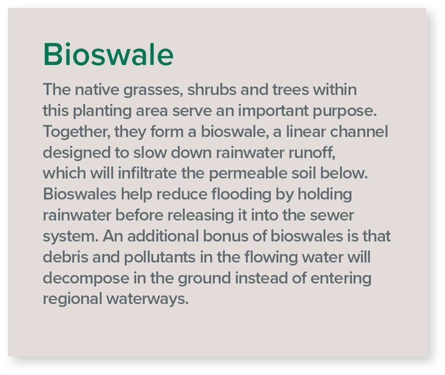
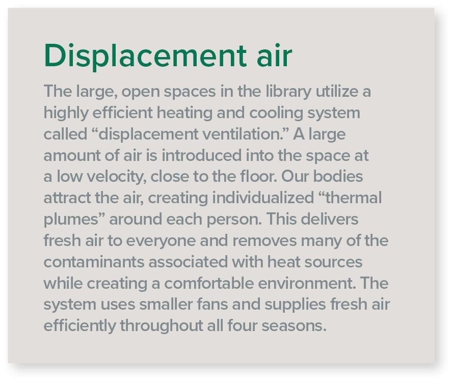
Marble Fairbanks included interpretive signage throughout the building to highlight the library’s environmentally sustainable design practices. These brief descriptions explain how and why certain design elements are beneficial to the environmental conditions of the library’s users (such as a displacement air system that conditions efficiently while removing contaminants), as well as to the well-being of the greater neighborhood and region (such as a bioswale that mitigates flooding of the city’s sewer system).
Interpretative Signage Topics:
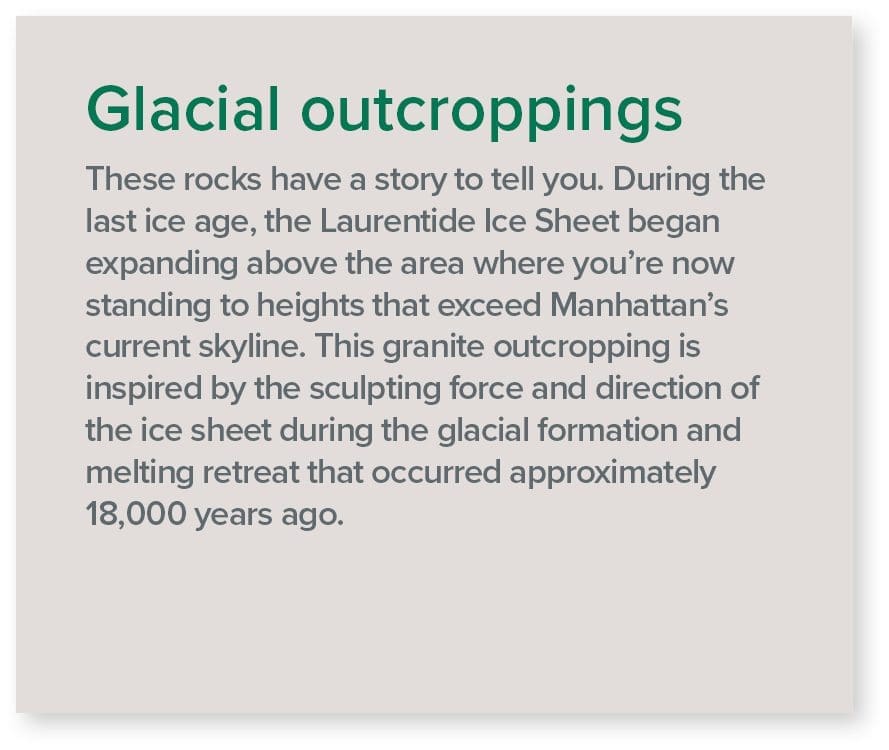
Glacial Outcroppings
Bioswale
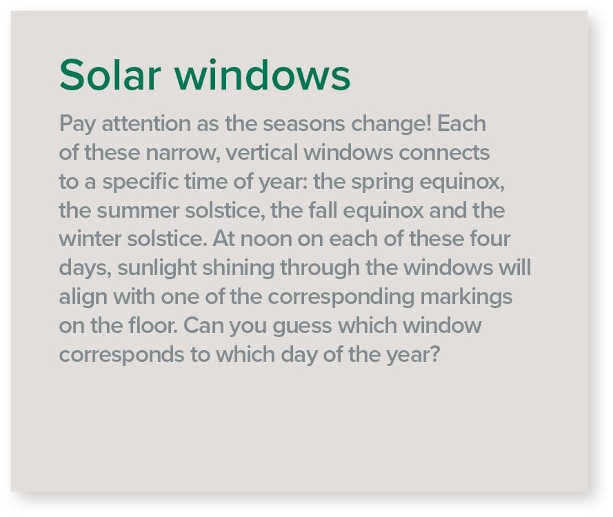
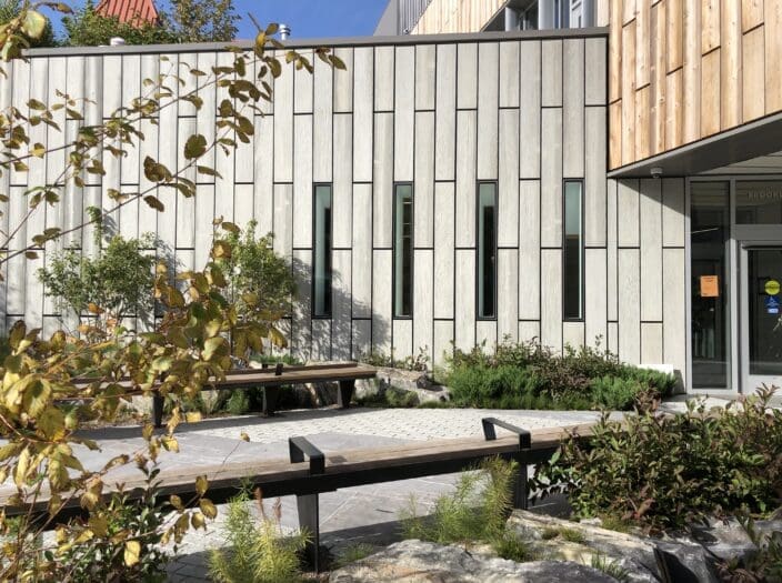
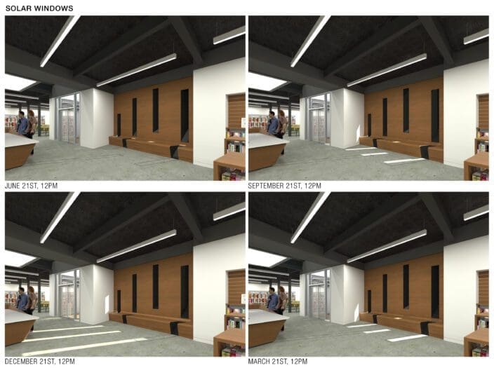
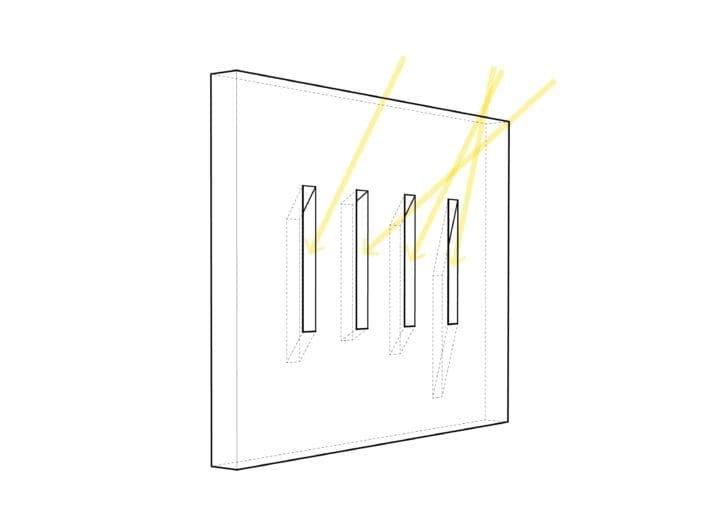
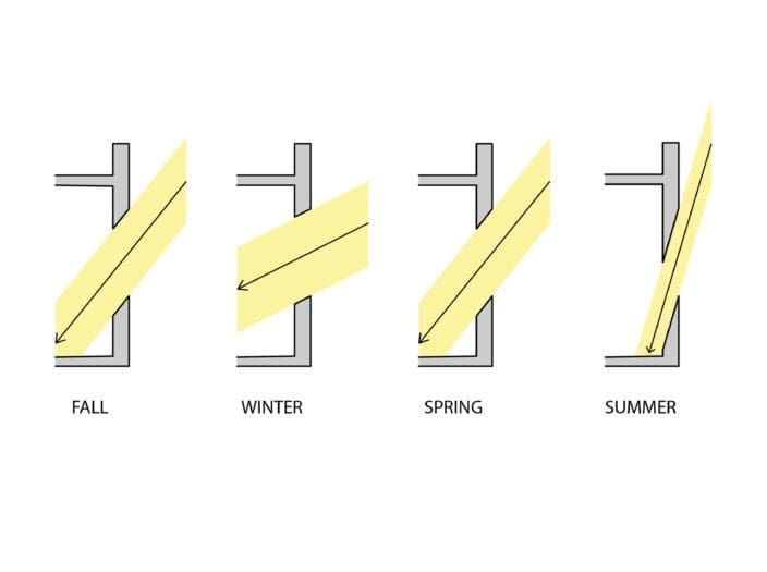
Solar Windows
Displacement Air
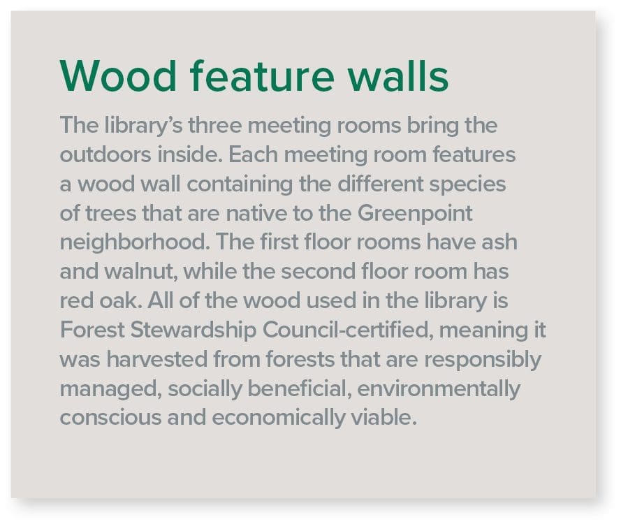
Wood Feature Walls
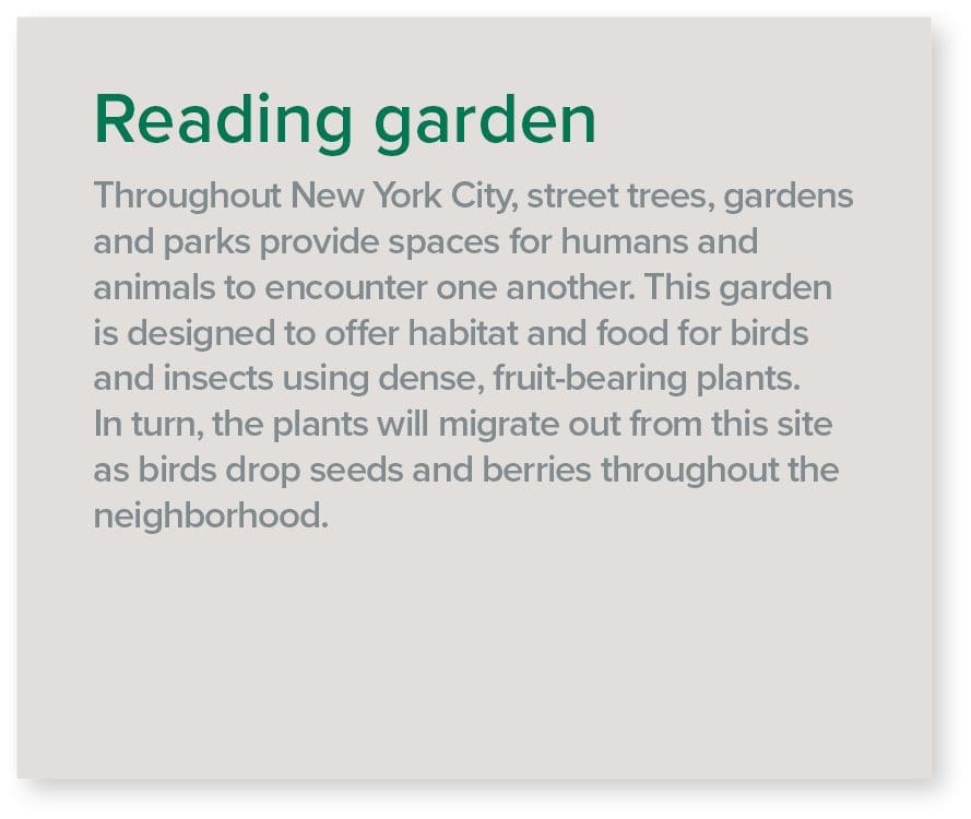
Reading Garden
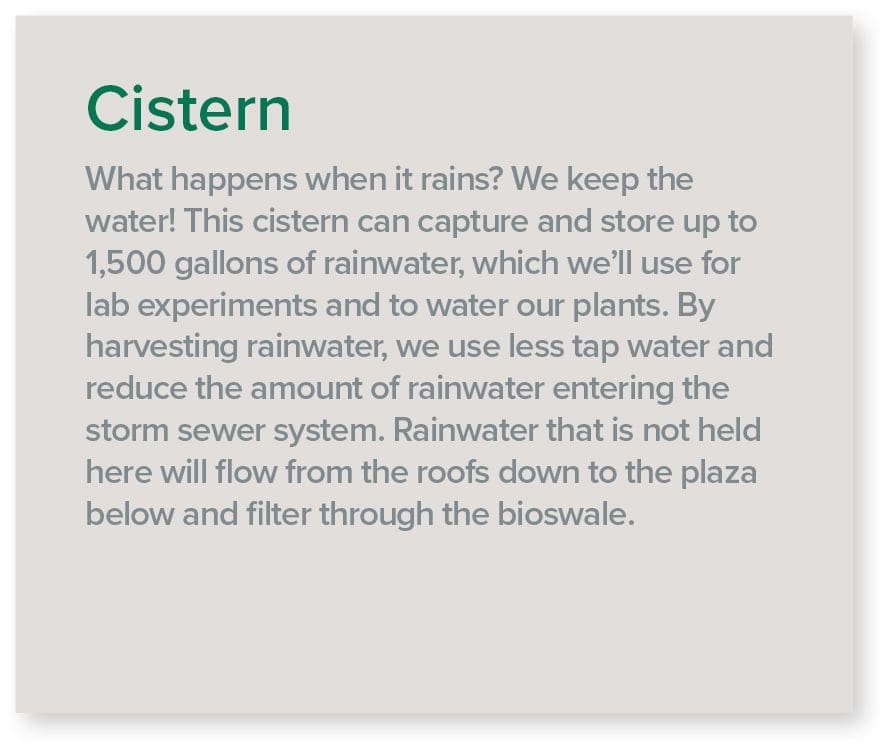
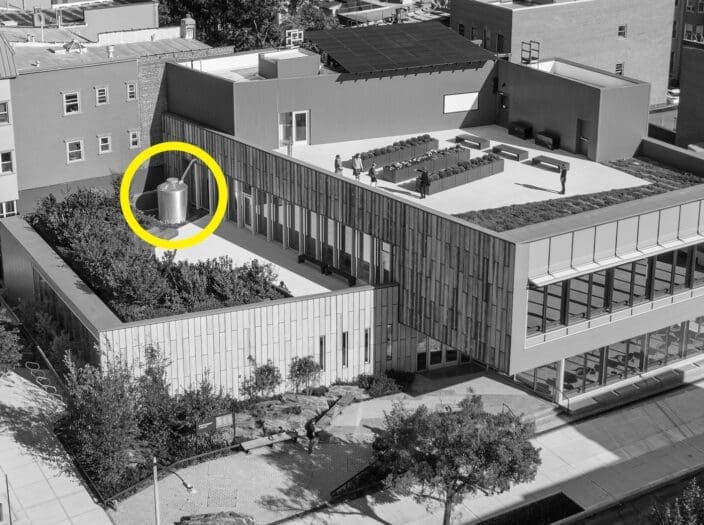
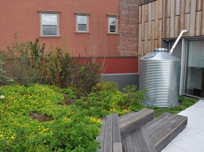
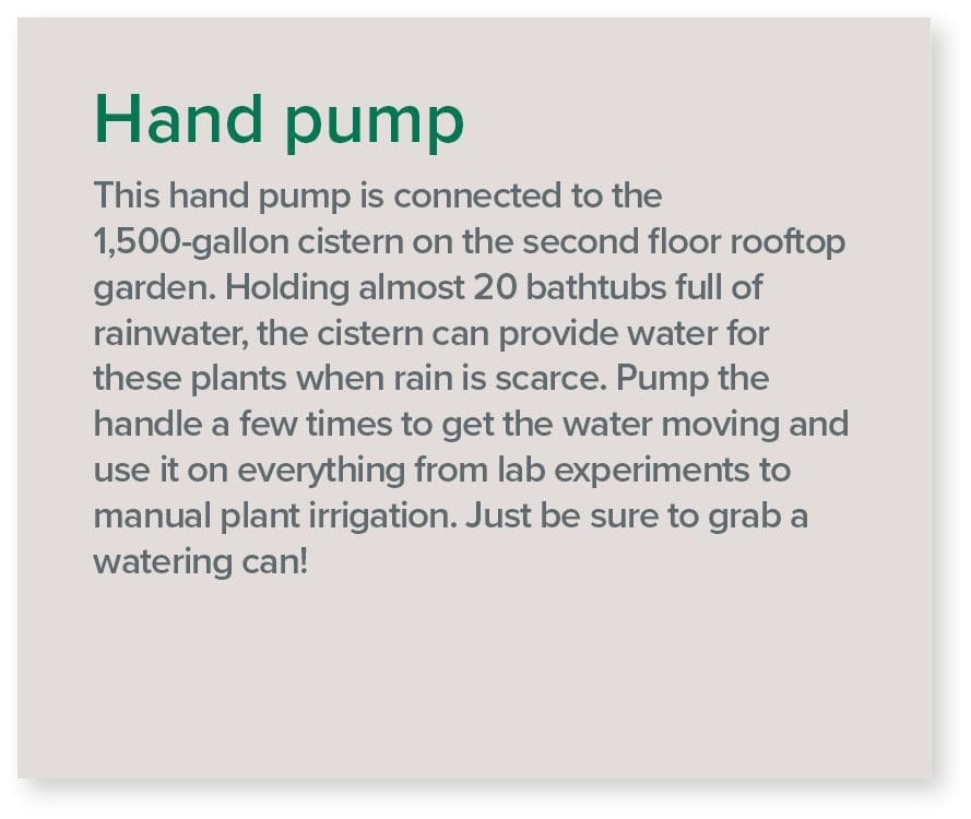
Cistern
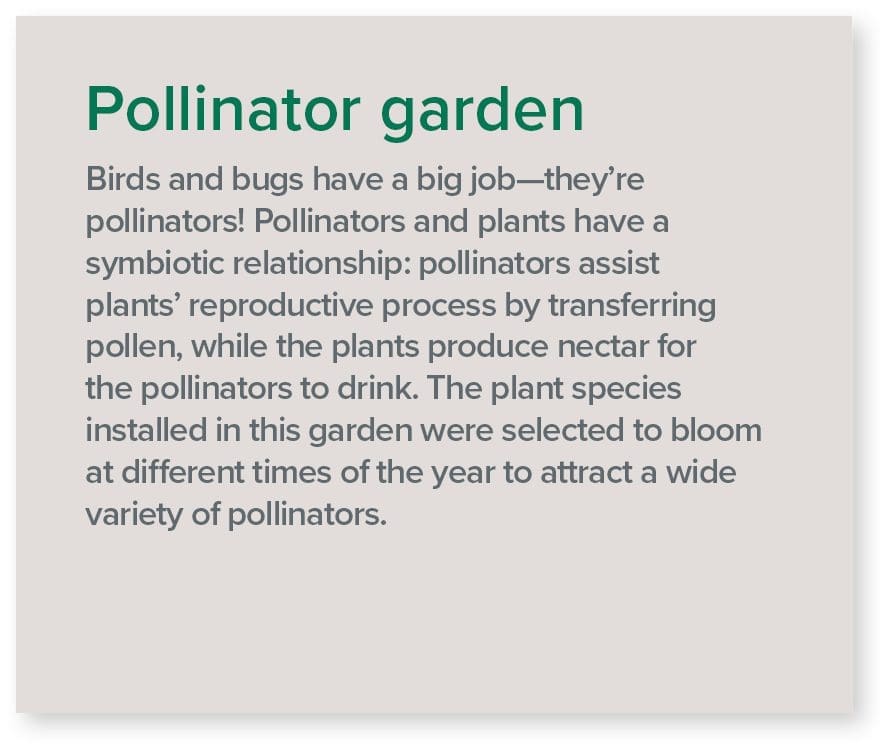
Pollinator Garden
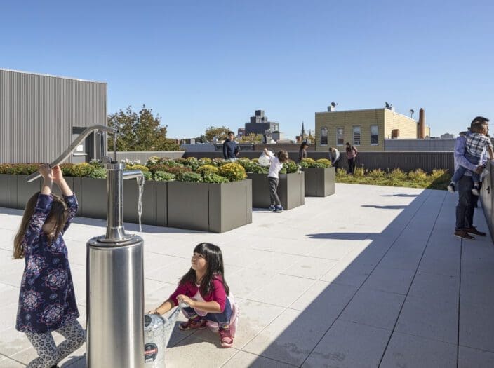
Hand Pump
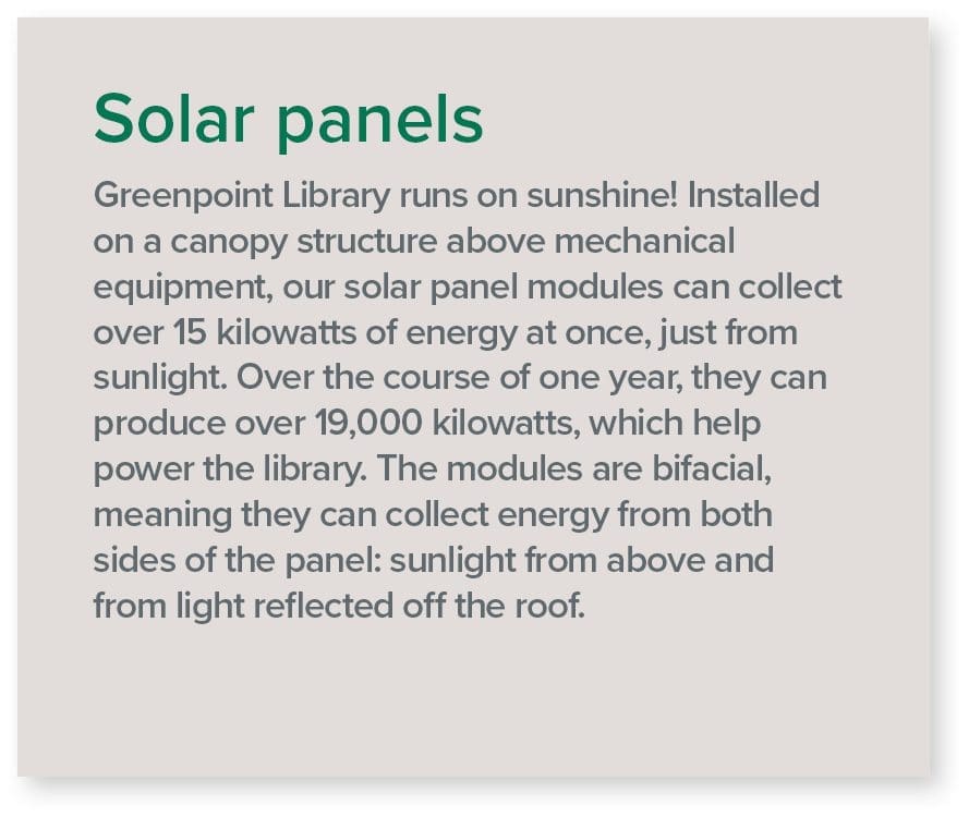
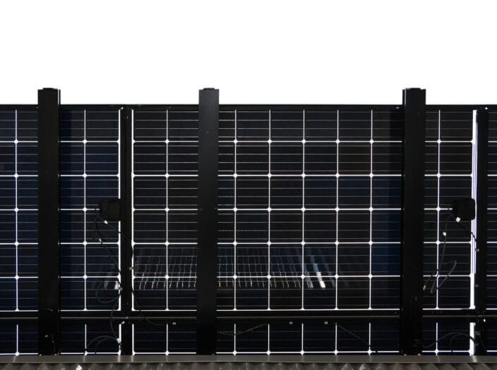
Solar Panels
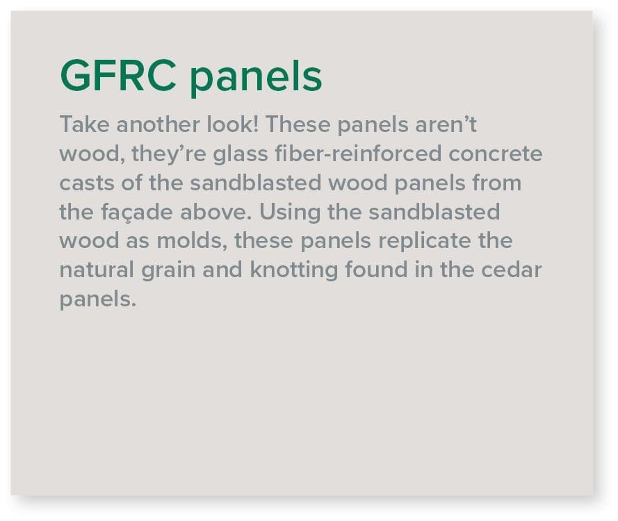
GFRC Panels

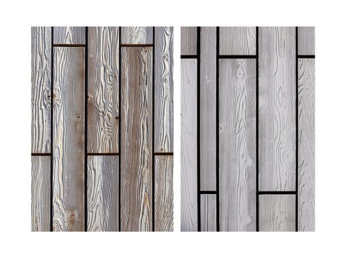
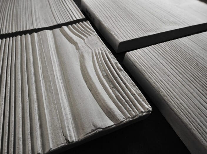
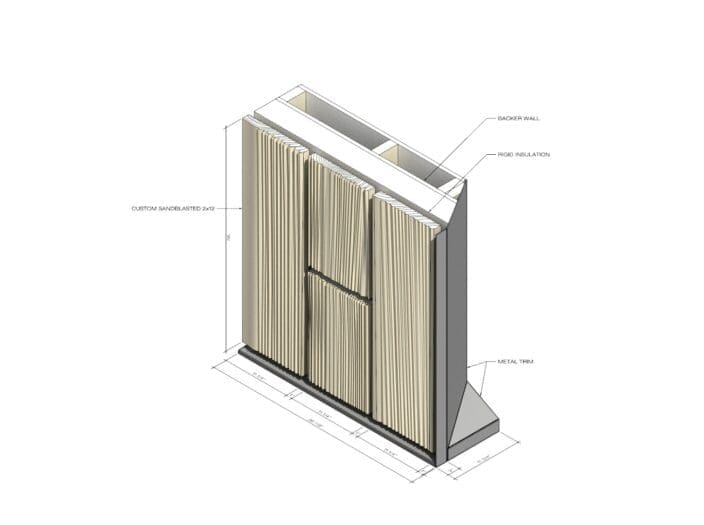
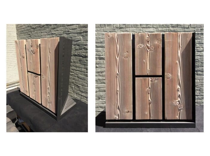
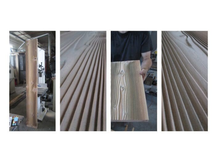
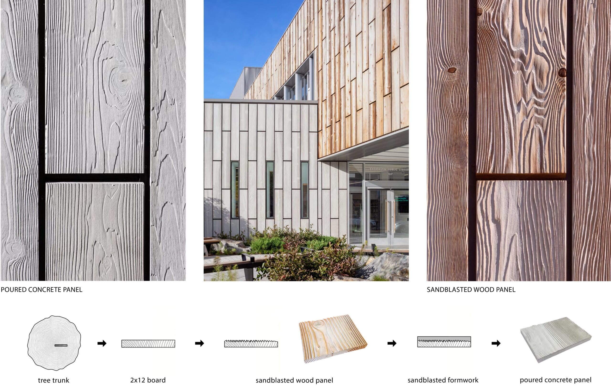
Facade Fabrication
The exterior wood and concrete wall panels were developed and fabricated in collaboration with Evan Eisman Company, a design, fabrication, and finishing studio based in the Brooklyn Navy Yard, located just ten minutes from the library site.
Working iteratively with their shop, we developed a sand-blasted technique for finishing the cedar panels, removing a small amount of the soft wood in the grain pattern, accentuating the natural pattern on the façade. We then utilized those sand-blasted panels to cast the glass fiber reinforced concrete (GFRC) panels that are located on the lower level of the building. Eisman and MFA worked together to determine the ideal amount of sandblasting required, in order to allow the wood to later become formwork for the fabrication of the GFRC panels used at the lower level facade.
Facade Fabrication Process
Layout of Sandblasted Wood Panels for the Library Facade
Environmental Activism
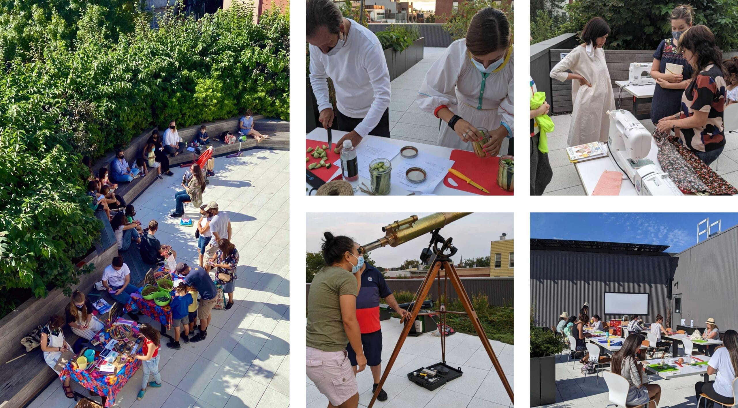
At the library’s inception, the community decided that—in addition to being a full-service library—the new center would be a hub for neighborhood residents of all ages to learn about the environment and sustainable practices through hands-on activities, speaker events, and guided research. The community also chose to make the new library a repository for primary source documents relating to Greenpoint’s history of environmental pollution and contamination. This has been made possible through BPL and the Greenpoint Community Environmental Fund’s (GCEF) creation of the Greenpoint Environmental History Project. The documents, photos, and recordings that form the repository at the library can also be accessed online through the BPL Digital Collection.
To lead community activism and outreach, BPL hired Acacia Thompson as the Environmental Justice Coordinator. She leads environmental education at the library and focuses on issues of environmental equity and access for the Greenpoint Community. She also leads the Greenpoint Environmental History Project, a role critical to the mission of documenting and preserving the environmental history of Greenpoint.
Acacia and the BPL team have created programming that leverage the building’s amenities and spaces: craft and science projects in the labs, stargazing from the roof, lessons in food-growing in the exterior planters, and yoga in the Demonstration Garden.
A Community for Hands-On Learning
Interactive VR
Click and drag to view the library
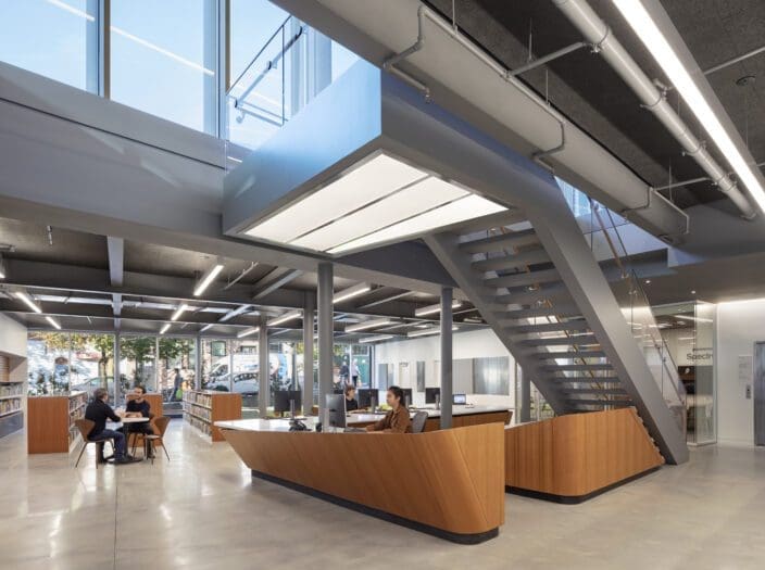
Information desk and stair
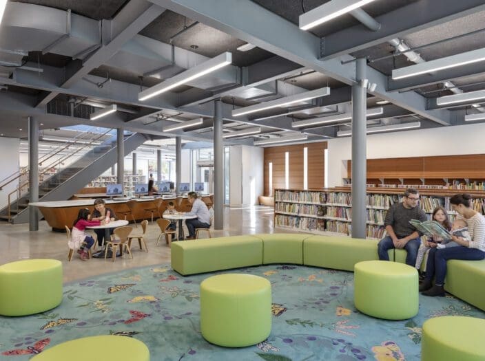
Children’s Area
View from stair landing
View of Eco Lounge